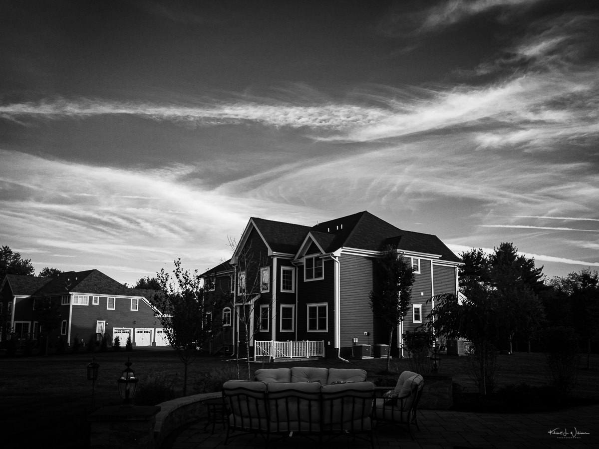
The view of the sky from my sister-in-law's backyard on Sunday evening.
Clouds — 29 September 2019 — Apple iPhone 7 + iPhone 7 back camera 3.99mm f/1.8
Island in the Net by Khürt Williams
Technology and Photography Musings. Established circa 2000.
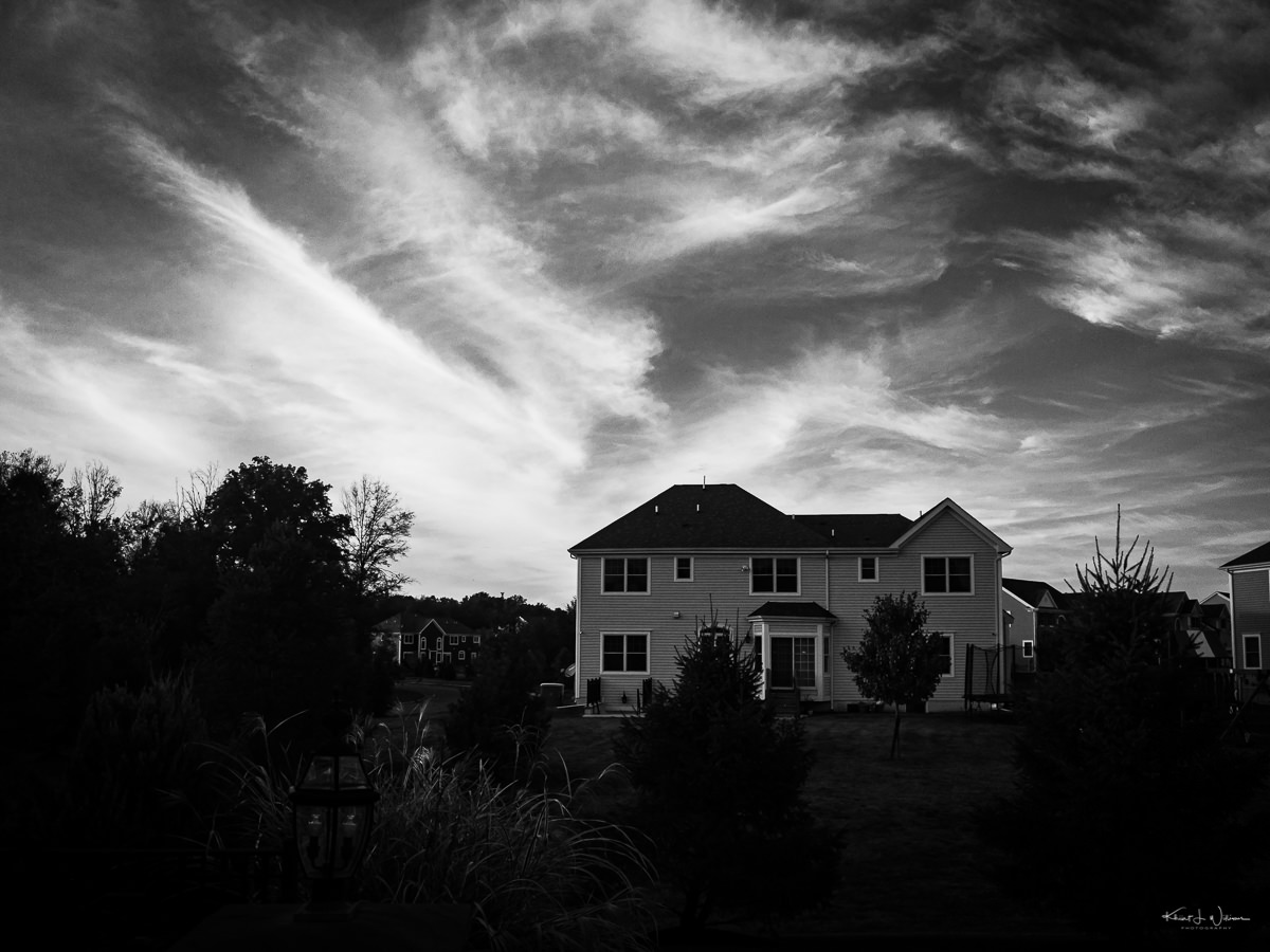
The view of the sky from my sister-in-law's backyard on Sunday evening.
Clouds — 29 September 2019 — Apple iPhone 7 + iPhone 7 back camera 3.99mm f/1.8
Ritchie Roesch recently announced his Film Simulation Challenge, which requires that the photographer load her camera with one film simulation recipe, capturing either 24 or 36 frames before changing settings. The photographer is forced to shoot with that one "roll" of the film until that roll is completely exposed. Ritchie's post from today reminded me that I had not yet submitted an entry.
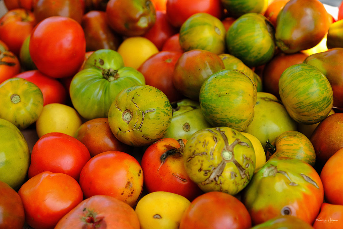
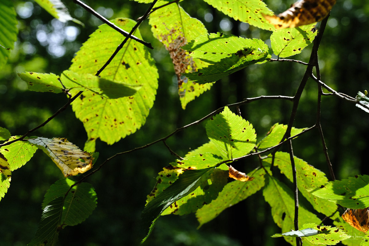
My first roll for the challenge I used a roll of Kodachrome II while walking around the main street in Hightstown. But this time, I used a modified version of Ritchie's Fujifilm X-T30 Velvia Film Simulation Recipe. The Fujifilm X-T2 lacks the Color Chrome Effect setting that is available on the Fujifilm X-T3/X-T30. All of the images in this post are straight out of the camera. I love how the colours of the flowers and the fruit "pop." Next year, I'll make a note to use this recipe to shoot the early spring foliage and flowers with an additional mental not to use it this fall for foliage.
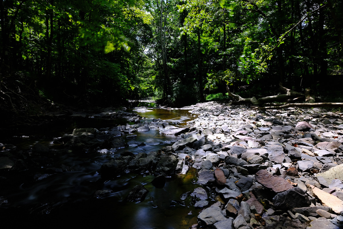
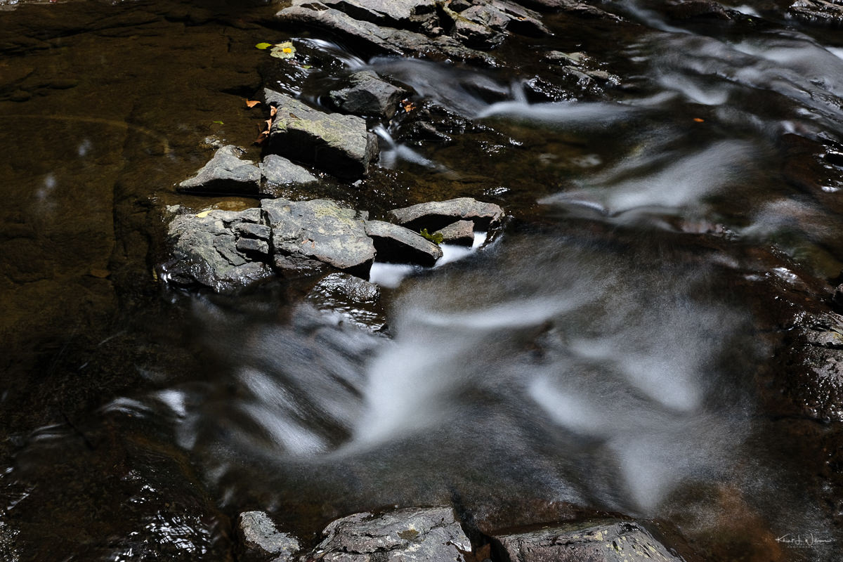
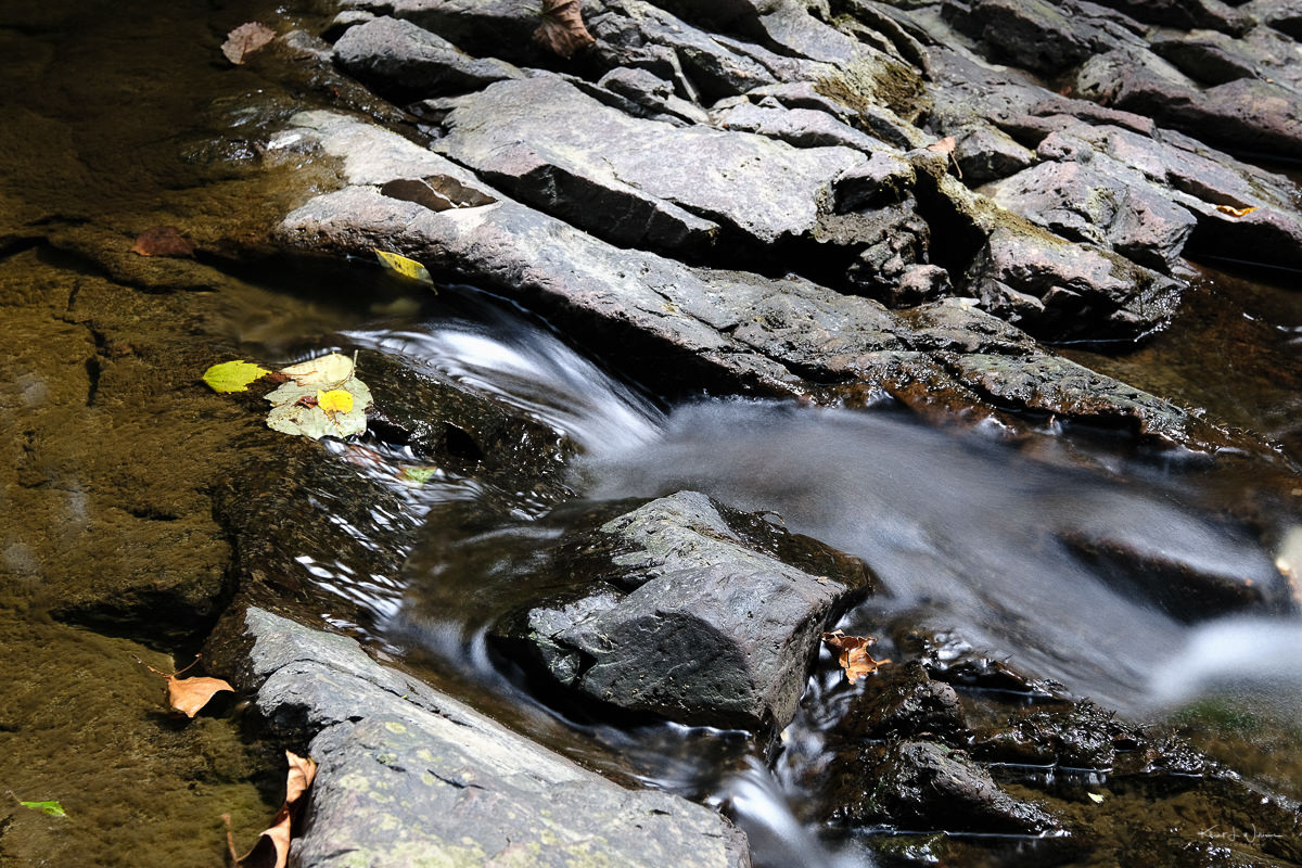
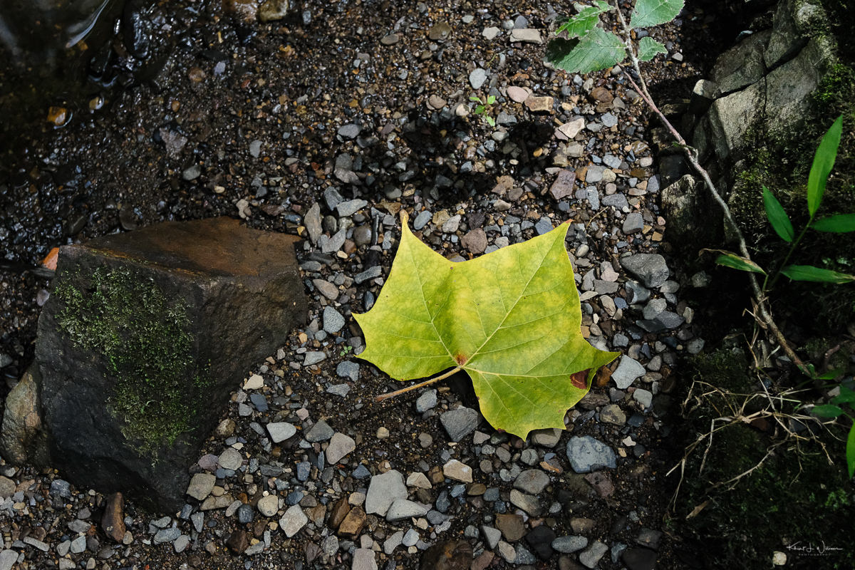
I captured some photographs at the Montgomery Farmers' Market then drove to Hollow Road, where I parked my car and walked down to the rock bed of the Rock Brook. As usual, the sound of the water rushing over the rocks and the wind blowing in the trees set me at ease. I was relaxed, noticing how green everything was and the lack of flowers. The occasional bright yellow butterfly floated by on the wind, too quick to photograph. I followed their flight through the trees into the distance.
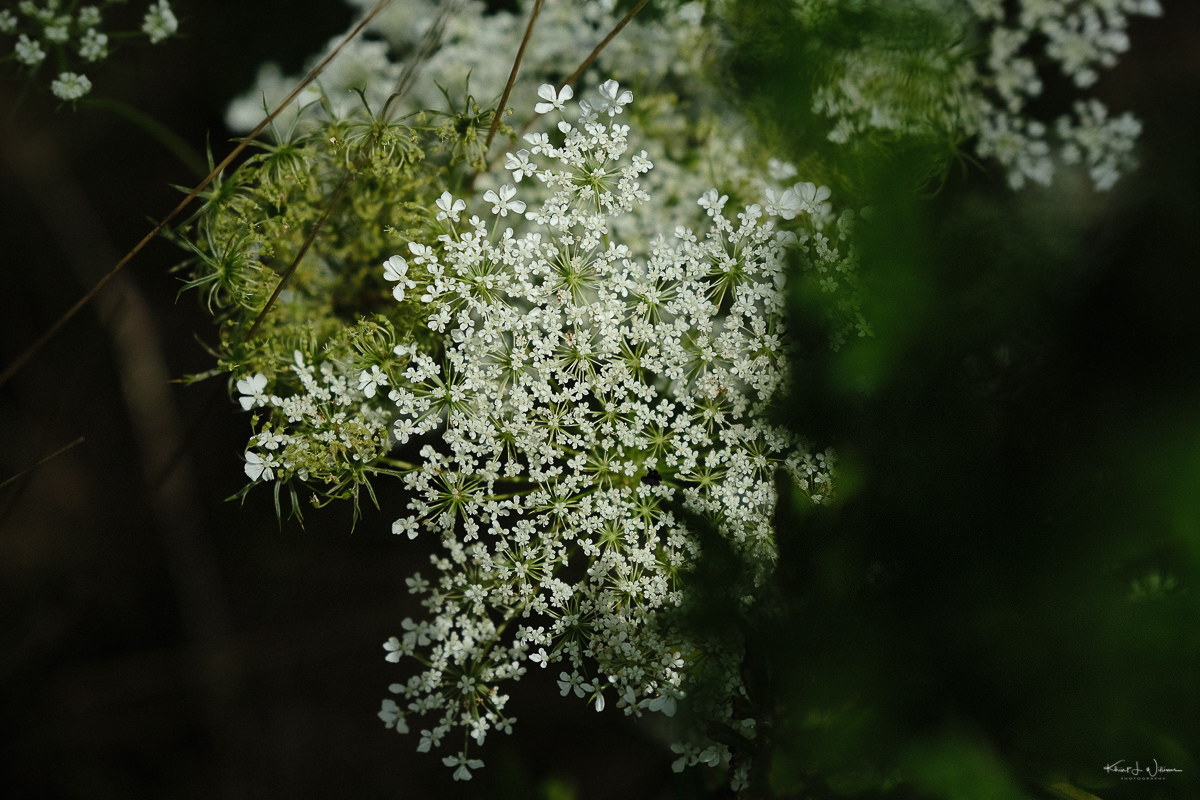
The silence was broken by the sound of my iPhone, a call from my sister-in-law, inquiring how my wife was feeling after her surgery yesterday. We chatted and made plans to take my nephews out for a wander in the woods to my photographic hideouts. On my way home, I stopped in at Hobler Park. I captured some images of art installation and the yarrow flowers, the only thing in bloom at this point in the high heat and humidity of August.
Here are the keepers from my roll of 24. I used a 10 stop neutral density filter to capture the images of the water on the Rock Brook.
Other entries in this challenge series.

Atop the hill…
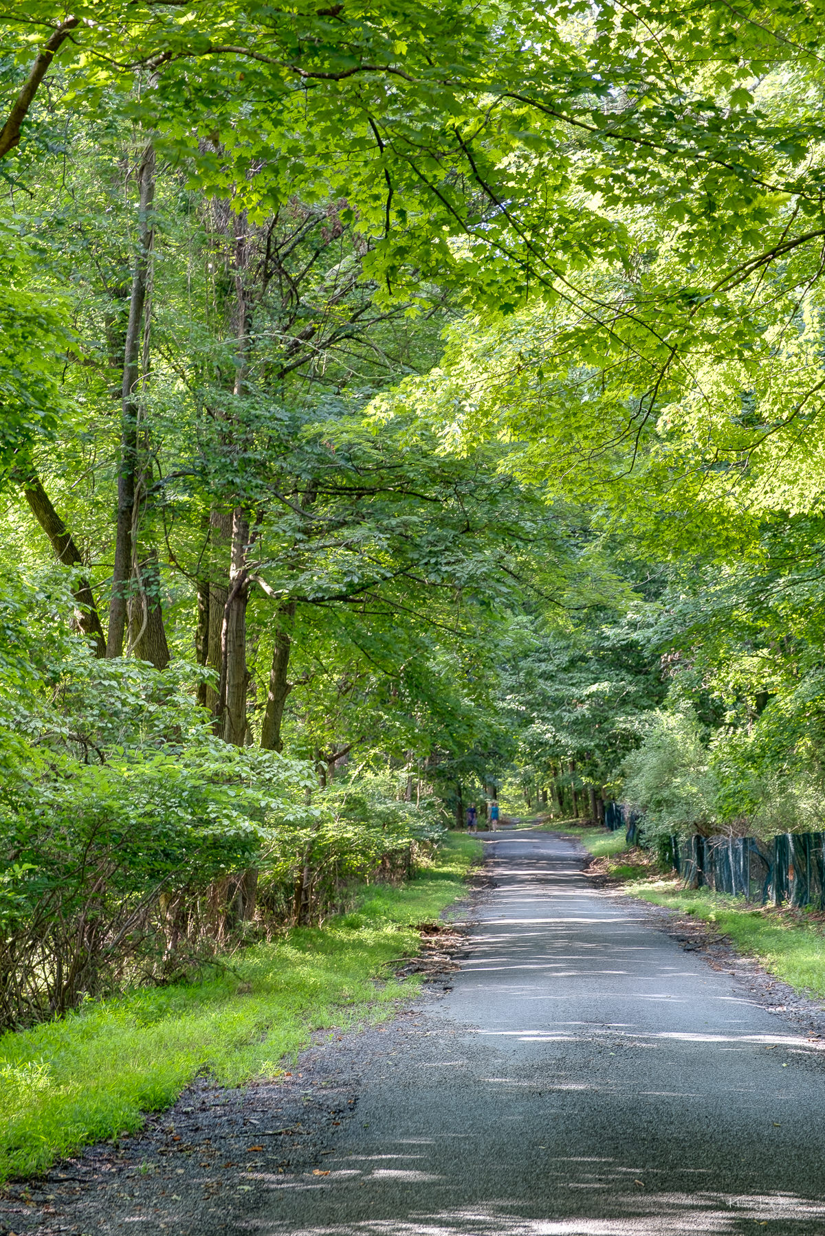
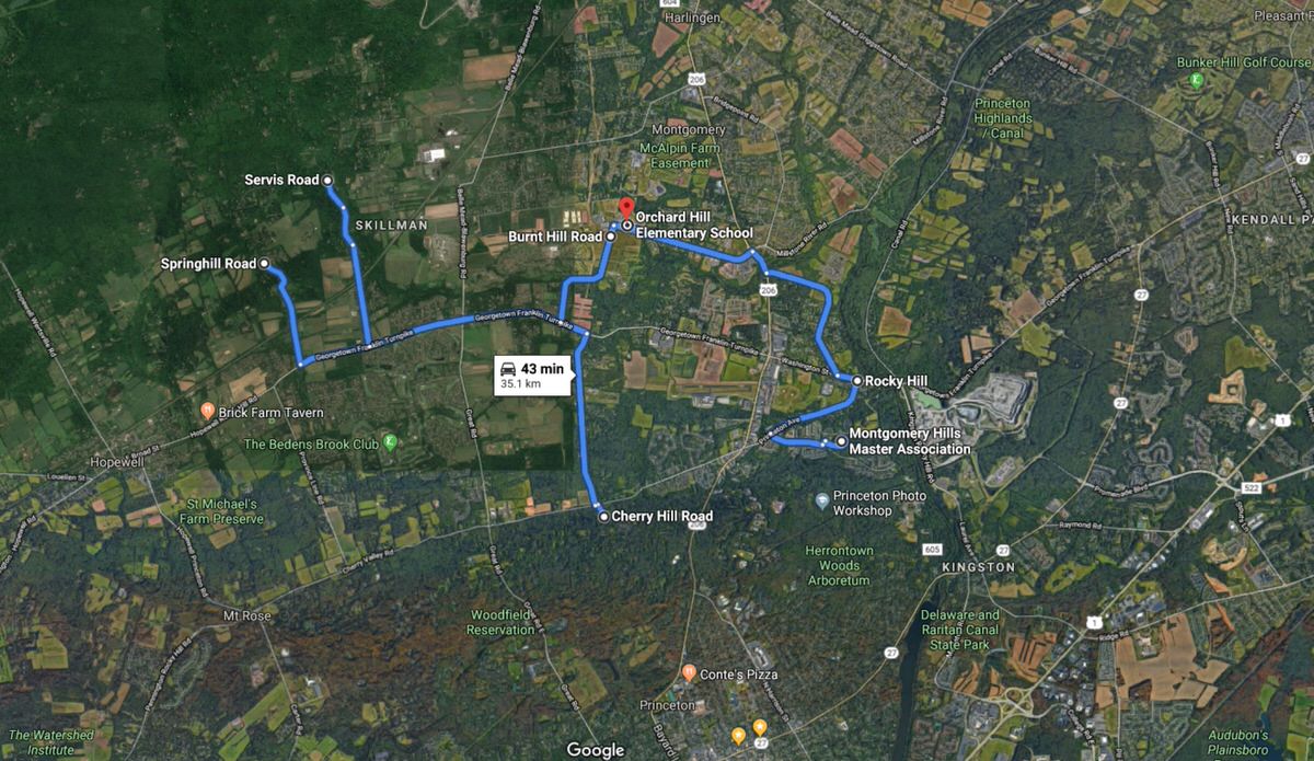
My townhouse community, Montgomery Hills, lies on the southern border of Montgomery Township in Somerset County, fenced in by the woods on the northeast side of Princeton's Autumn Hill Preserve and the nearby historic village of Rocky Hill, 2.9 km away, at the foot of the Rocky Hill Ridge and across the waters of the Millstone River, along the D&R Canal Trail.
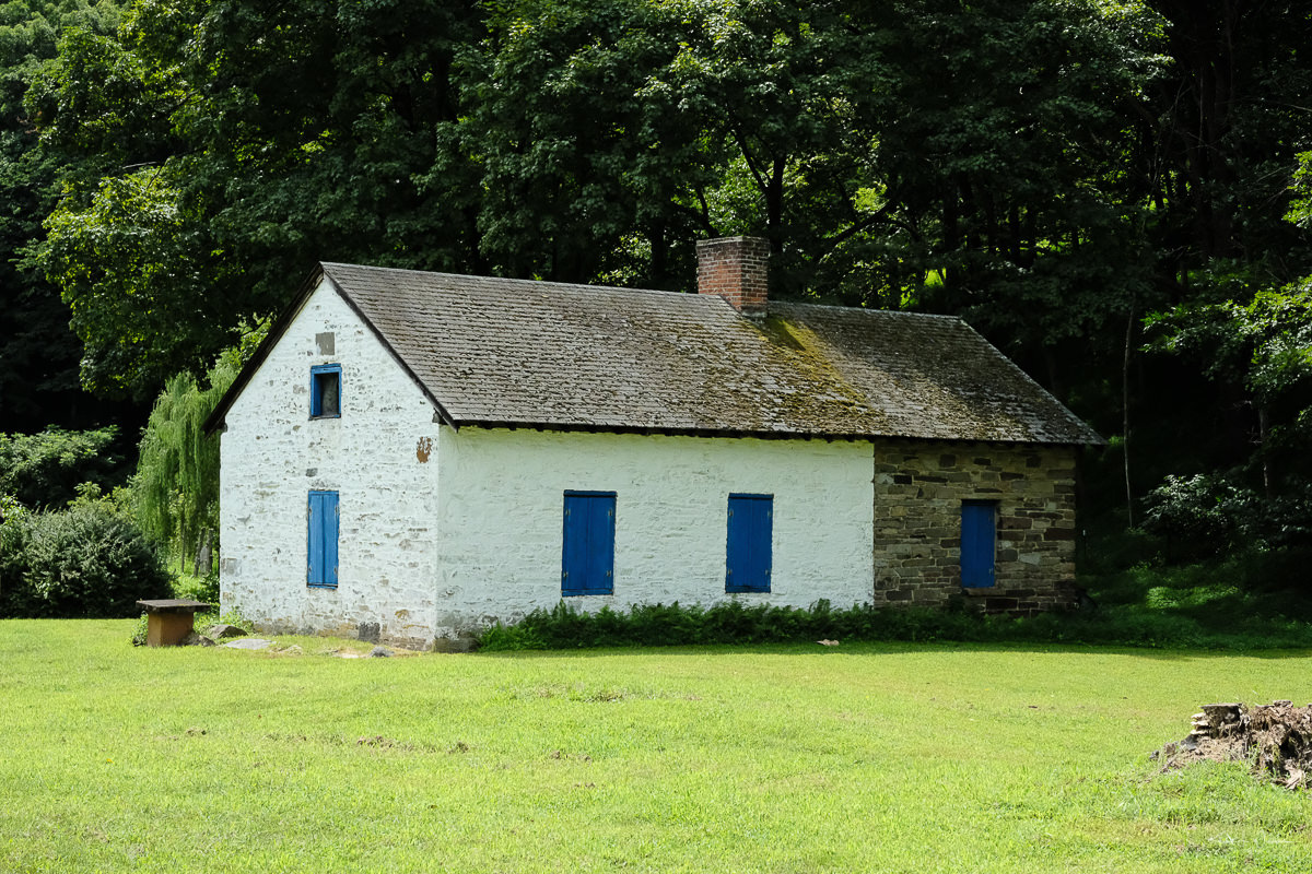
I've photographed many of the historic homes and buildings in Rocky Hill over the last 18 years, but the challenge keyword is "hill" but I wanted to capture images for the challenge, so I started first with Rocky Hill.
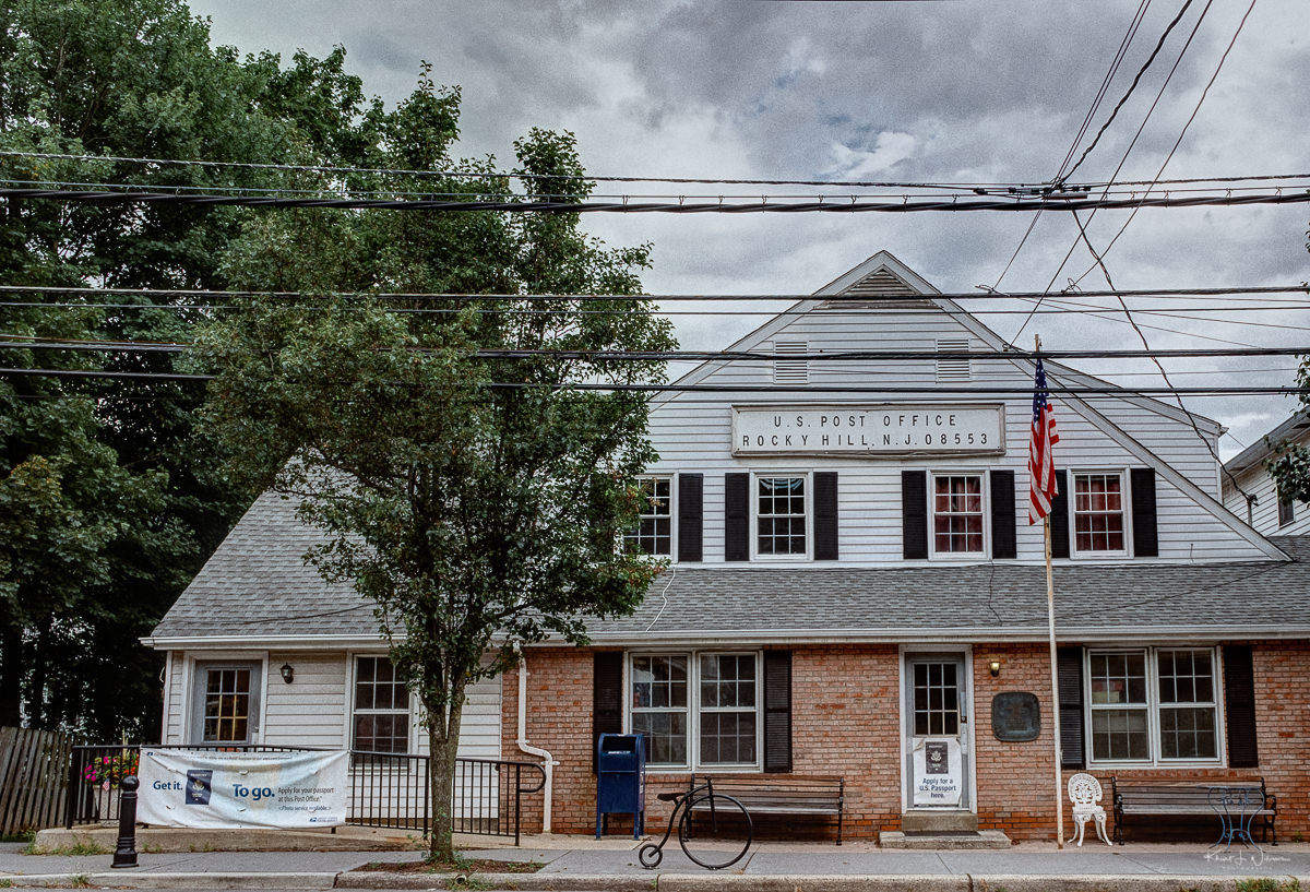
I can't say much about the post office. All my mail goes through the post office in Carnegie Center, which serves several areas under the "Princeton "zip codes (five).
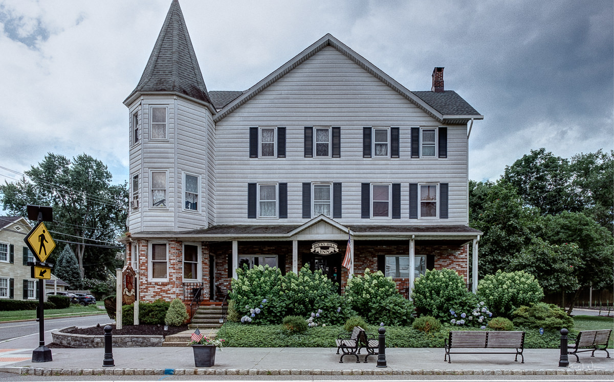
Built circa 1745, the Rocky Hill Inn is a historic colonial inn that by the 1800s had become a "fashionable summer excursion stop-off for city folks". Today it is a gastropub with multiple rooms that serves delicious American pub-style burgers and craft ales.
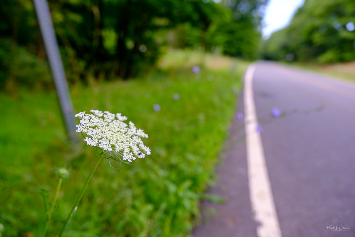
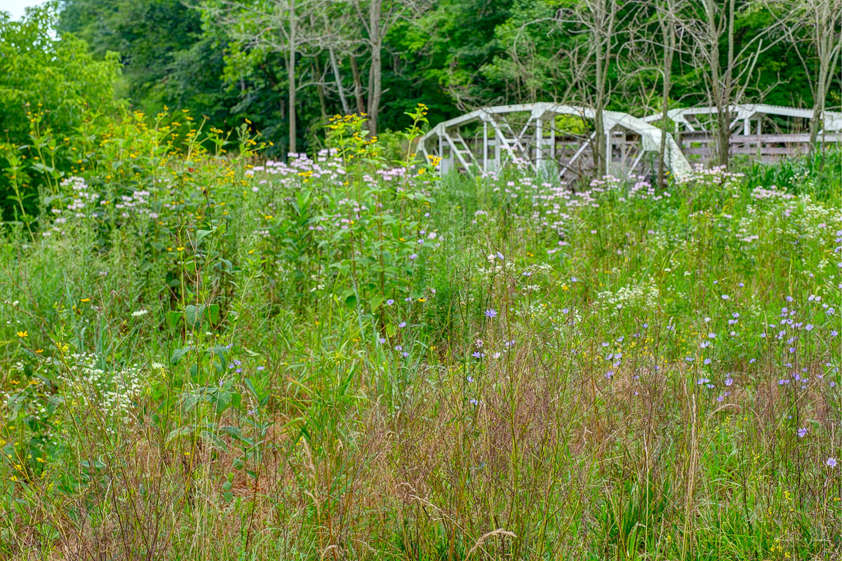
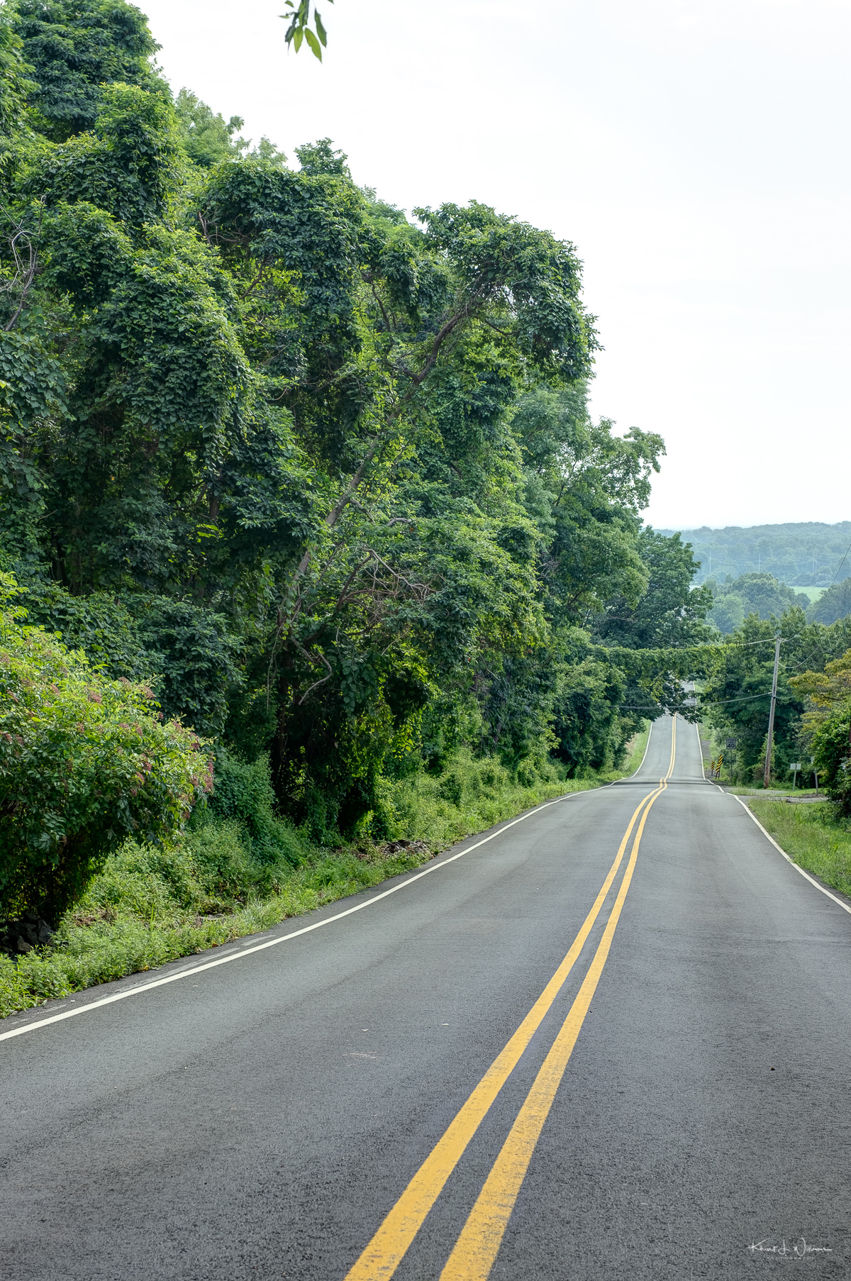
From Rocky Hill, I drove 7 km west over to Burnt Hill Road in Skillman, passing Cherry Hill Road on the way. The roads in Montgomery Township are narrow one-lane roads, the type you would expect to find in a small (former?) farming town, with steep embankments and ditches in many areas, no roadside and no sidewalks. I parked in a clearing on Burnt Hill Road near a hedgerow of wildflowers across the road from an abandoned farm bridge for the images on Burnt Hill Road. There was just enough space to keep the car mostly out of the road but kneeling or standing to take photographs, and I felt uneasy each time a vehicle approached.
From Burnt Hill Road, I drove over to Spring Hill Road, but I didn't find anything interesting to photograph. Spring Hill Road, which is narrow and winds its way up into the trees and over to East Amwell Township, is a fun drive in the right car. I was reminded of the weekend road trips we would take along the only "one car can pass" roads in Bequia packed into the back of Dad's Mini Cooper.
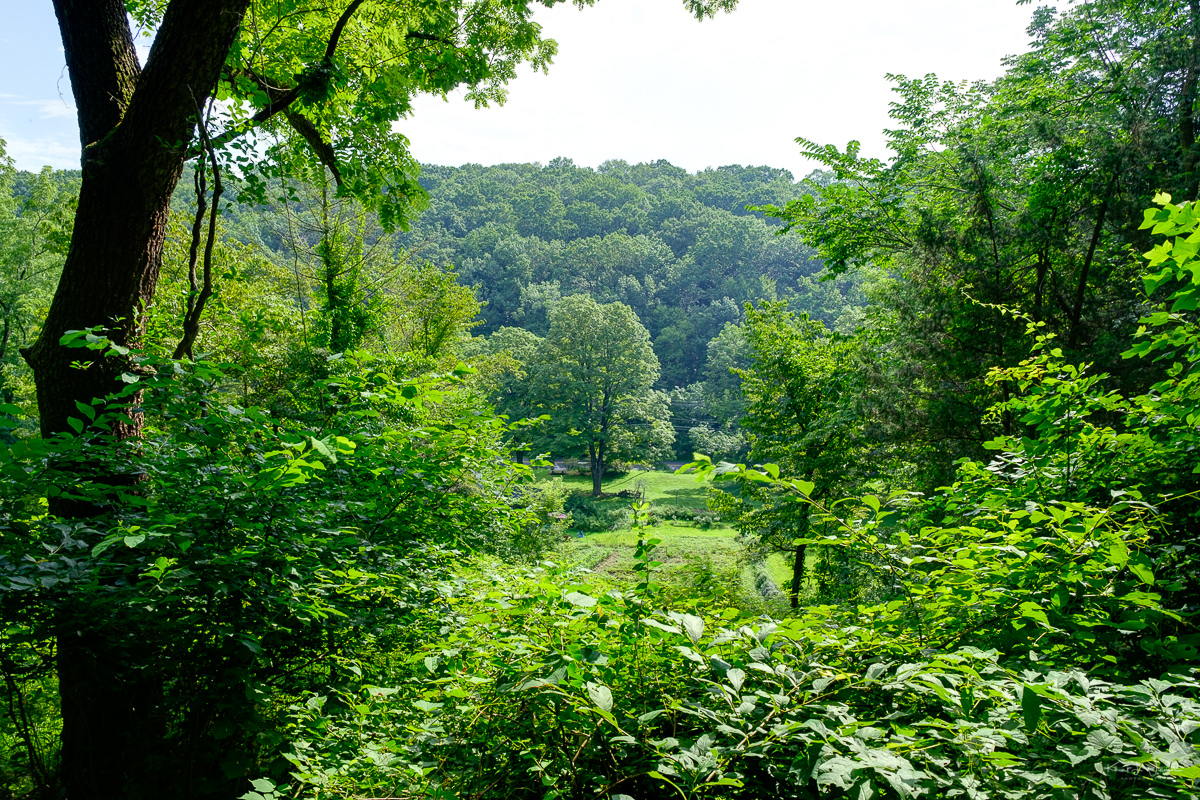
While enjoying the ride, I realised that photographing examples of the hills around the area would be challenging. There is no open plateau to stop and see the valley below and no open fields below to photograph the hills. Perhaps I should have gone hiking.
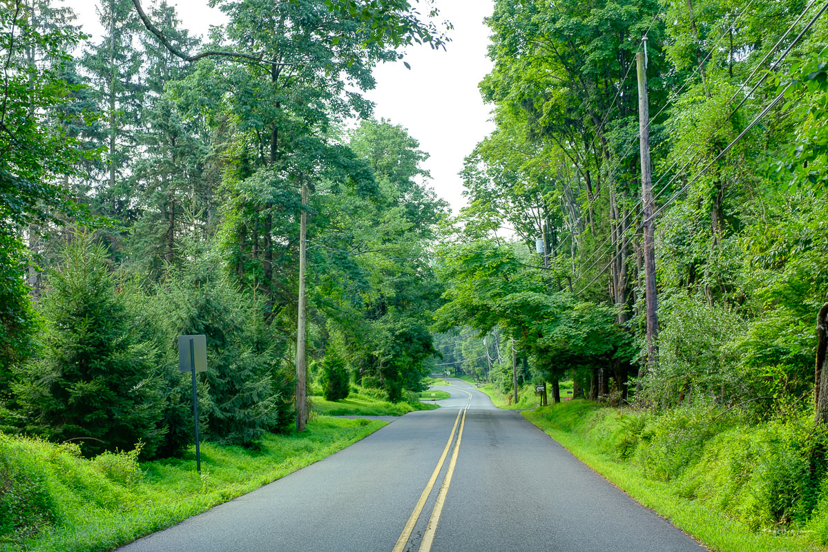
From Spring Hill Road, I drove to one of my favourite roads, Hollow Road on the border with Hillsborough Township, which has a spot where I usually park to photograph the Rock Brook, but this time I drove up to the top of Servis Road, hoping to see through the trees to the homes below. No such luck, and I had to quickly hop back into my car when I saw a pickup truck approaching. Servis Road is very narrow, and I doubted the pickup truck driver could get past our Acura RDX.
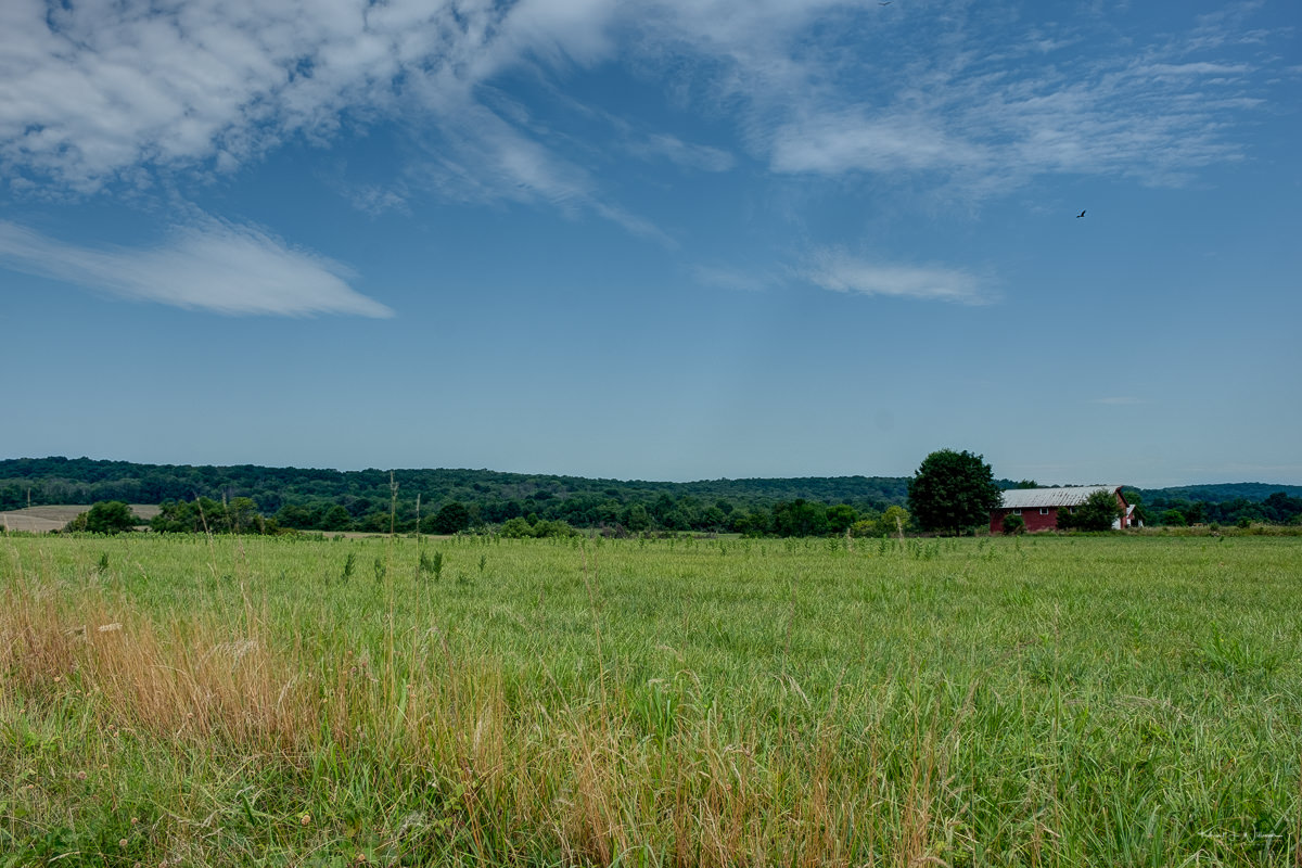
From Servis Road, I drove over the one-lane bridge that connects Hollow Road to Grand View Road and down the hill to the bottom of Grand View near the entrance to Johnson & Johnson. I grabbed some photos of the hills in the distance.
I was disappointed, decided to head home, and took Mountain View Road to Cherry Hill Road, to County Route 518 to Orchard Hill Road and then back home.
The remainder of my images were captured from the car's driver-side while I parked on the roadway, keeping a close eye for oncoming traffic. At some point, I held the camera out the window with my right hand while driving with my left hand. It was dangerous and not ideal.
I was out capturing these images for about 90 minutes, with almost half of that time spent driving. My wife saw the disappointment on my face. She reminded me that my grandparents (Ollivierre) lived in a windy area at the top of Monkey Hill in Bequia, which is also the name of my consultancy. The image below was capture on an APS film camera while visiting my grandmother in the summer of 1998.

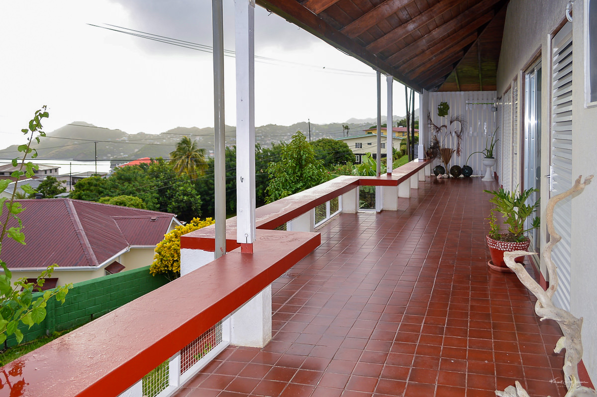
My mom took this photograph of the family house on Dorsetshit Hill, near Kingstown, Saint Vincent, where I spent some of my youthful years and last years of high school. It's a partial view, from the wrap-around veranda, of the Kingstown harbour and the mountains. The word verandah, which I have always used in the British West Indies, but rarely hear in the USA< is from the from Hindi, but research indicates that the veranda itself originated in the British West Indies. I digress, but the verandah and British Colonial architecture is something that I hope to someday explore in detail with my camera.
Dorsetshire Hill Road is a long winding road that leads down to Kingstown from Dorsetshire Hill. At the foot of the road is an intersection of several streets near a neighbourhood historically referred to as "Sion Hill". It's where my dad grew up.