Rock Brook

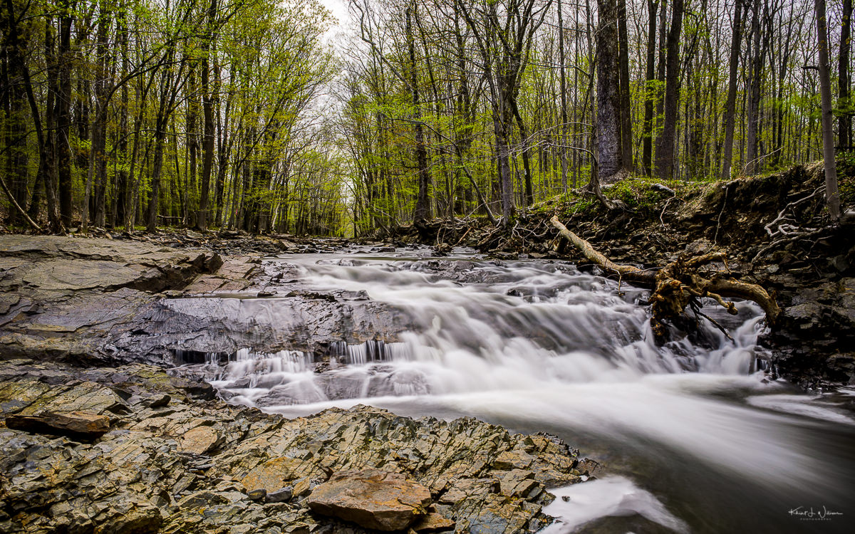
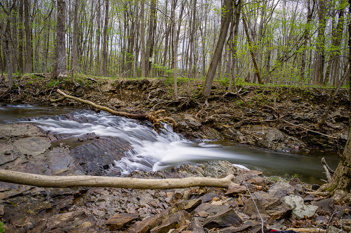
I drove to 360 Grandview around 8:30 AM and walked around for an hour enjoying the peace and quiet. The recent rains added some "life" to the stream so I used my Neutral Density filter and a trip to get some "white water" photos. But these photos were not taken at the Rock Mill Preserve. These were taken along Hollow Road just north of Camp Meeting Avenue. I pulled the car over, grab my camera, ND filter, and tripod, and walked down to the stream.

I spent about 30 minutes working on composition and lighting. At first, I used my Nikkor 35mm f/1.8 but realized that the Nikkor 18-55 f/3.5-5.6 would give me more choices. I had to run back to the car and get it.

Computing the exposure values for the use of an ND filter can be complicated. The Hoya NDx400 is a 9 stop -- "Big Stopper" -- ND filter. It's nearly impossible to focus once the filter is on the lens. Ed Velez told me about the PhotoPills app. This was my first time using it.

Nikon D5100 + Nikon 35 mm f/1.8 @ (35 mm, f/11, ISO100), Copyright 2014-05-04 Khürt L. Williams

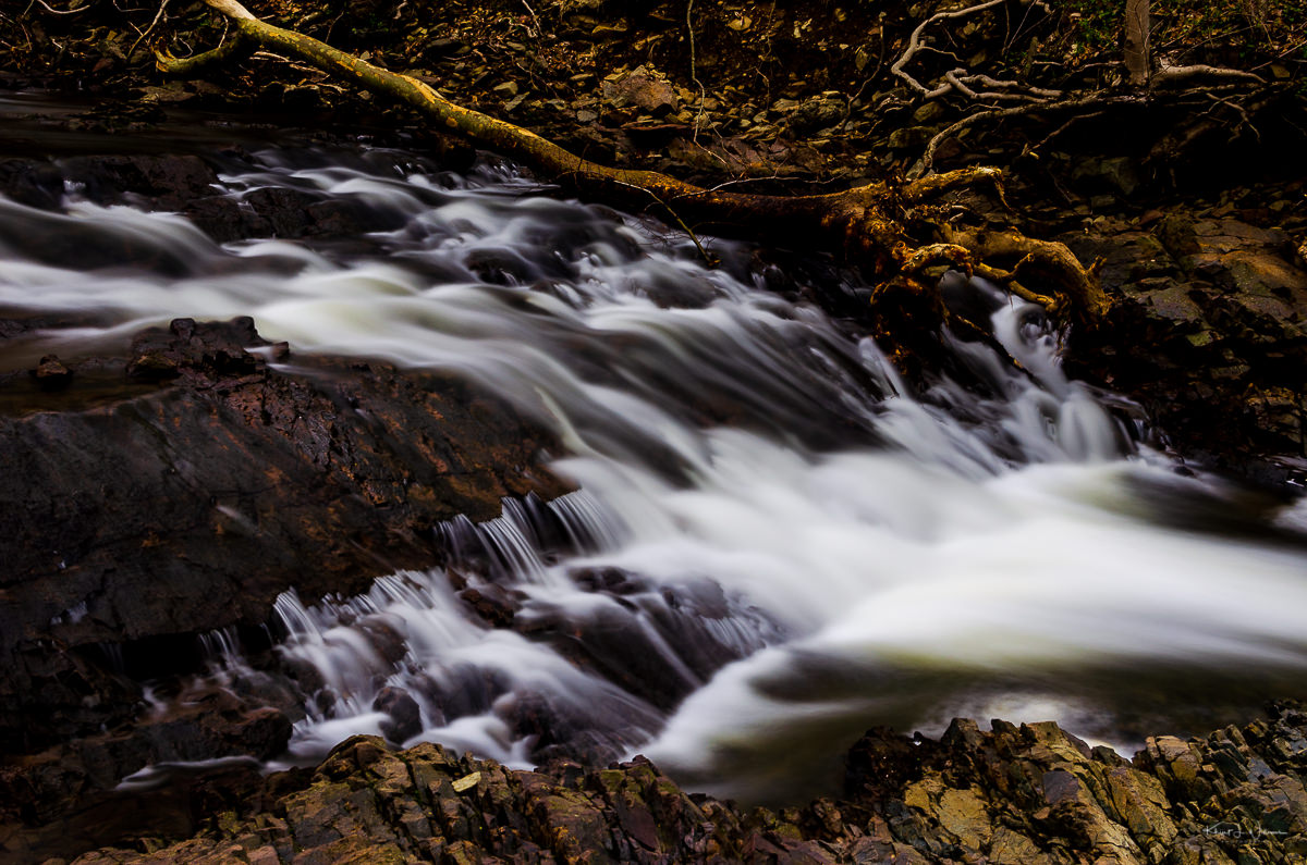
The app helped me easily calculate equivalent exposures with the filter in the available light. For example, without the filter, the exposure for the camera setting for correct exposure was at 1/13s at f/16. With the Hoya filter, the equivalent exposure was 17 seconds at f/16. I couldn't get 17 seconds on my D5100 I used 15 seconds or 20 seconds.

NOTE: The D5100 is a crop sensor -- APS-C -- camera. The full-frame equivalent of f/16 on APS-C is roughly f/10.33 which is approximately f/11. So I used an aperture of f/11 for these shots.

Nikon D5100 + Nikon 18-55 mm f/3.5-5.6 @ (18 mm, f/11, ISO100), Copyright 2014-05-04 Khürt L. Williams

Wild Edibles and Ecology with Rachel Makow and Montgomery Friends of Open Space

[exif id="11185"]

[exif id="11186"]

[exif id="11187"]

[exif id="11188"]

[exif id="11189"]

[exif id="11190"]

Intensive Yellow

On Saturday — before the storm broke — we had a bit of family hiking fun. Bhavna had registered for use to go on a geocaching hike in the Sourland Mountain Preserve as part of a fundraising event planned by the Sourland Planning Council.

We arrived early and were briefed for 30 minutes on the basics of geocaching by Eric Lemon. Eric and his sons are avid geocaches who go by the moniker “Twisted Lemons” on Geocaching.com.

Once we were acquainted with the terminology (apparently we are muggles) and had entered the cache coordinates into our iPhones — I used MotionX GPS and Bhavana used the free Geocaching app, we set off into the woods. The trail was easy enough and about 20 minutes into it we, a motley crew of about a dozen adults and kids, found the cache.

Bhavna was disappointed. She had expected we would be out for some strenuous hiking and exploration. Eric told a few of us more ambitious hikers about several other caches and Bhavna was resolved to find one more.

We followed the gas pipeline up the hill before “bushwhacking” our way through a tall thicket of yellow flowers, grass and burr weed. The kids complained about being hot and hungry but we persisted. Kiran found the second cache after about an hour. We were triumphant but exhausted, sticky and hungry so we headed back down the hill to the base of the event where we dined on delicious pizza from the Nomad Pizza truck.

If you look closely you can see that I have passed the image through a texture. In this case, Topaz Clean.

The original image. | Saturday 8 September, 2012 | Nikon D40 | 18-55 mm f/3.5-5.6