Hiking La Soufrière Volcano

Hiking to La Soufrière volcano with my Uncle Clifford and my cousins is an adventure I will never forget.

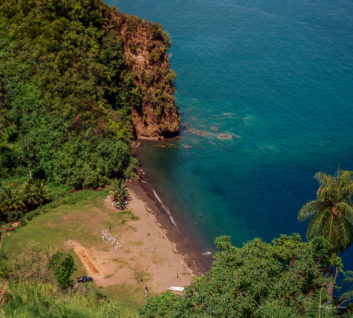
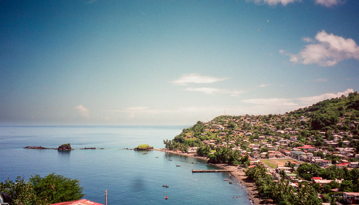
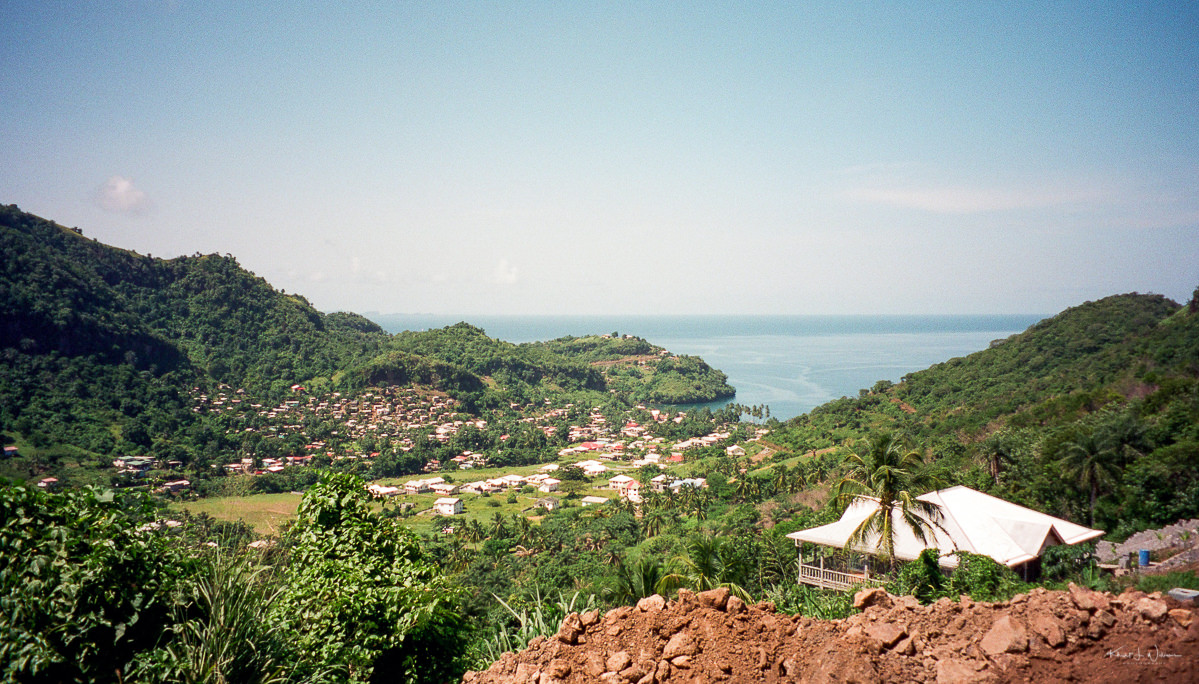
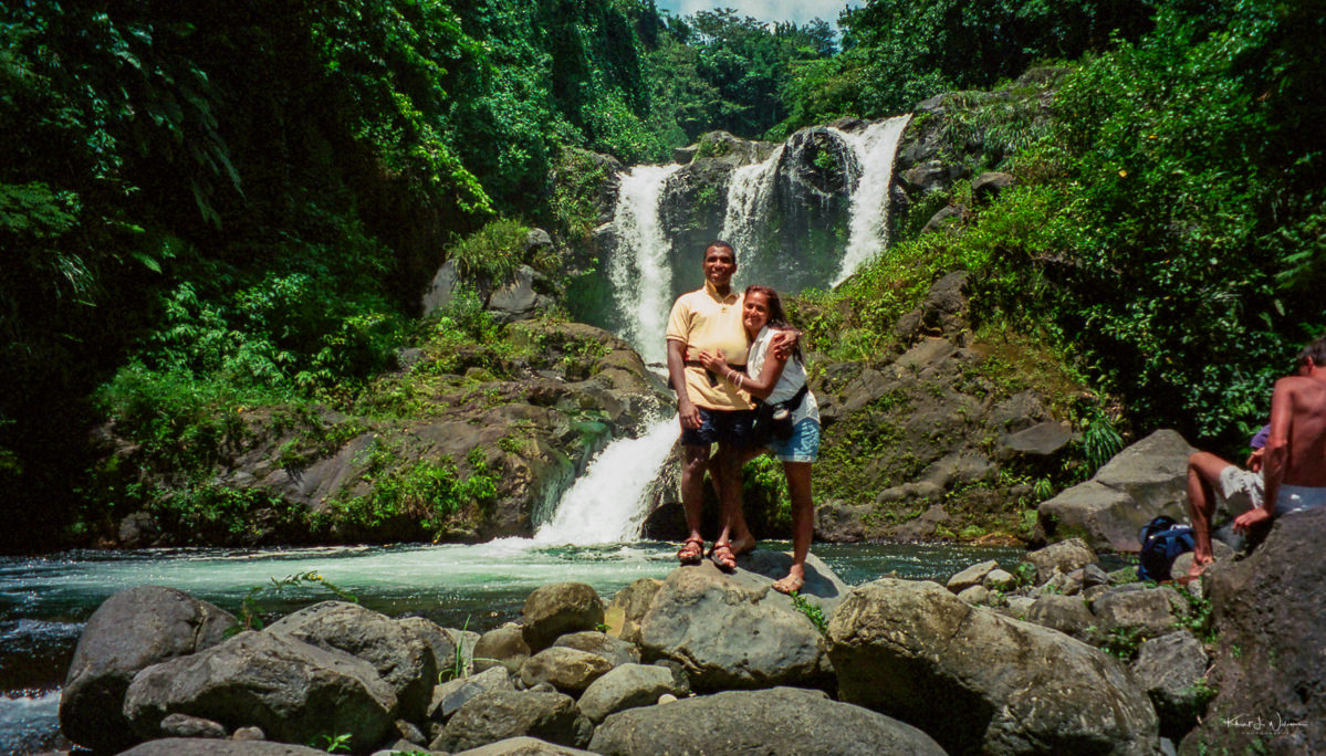
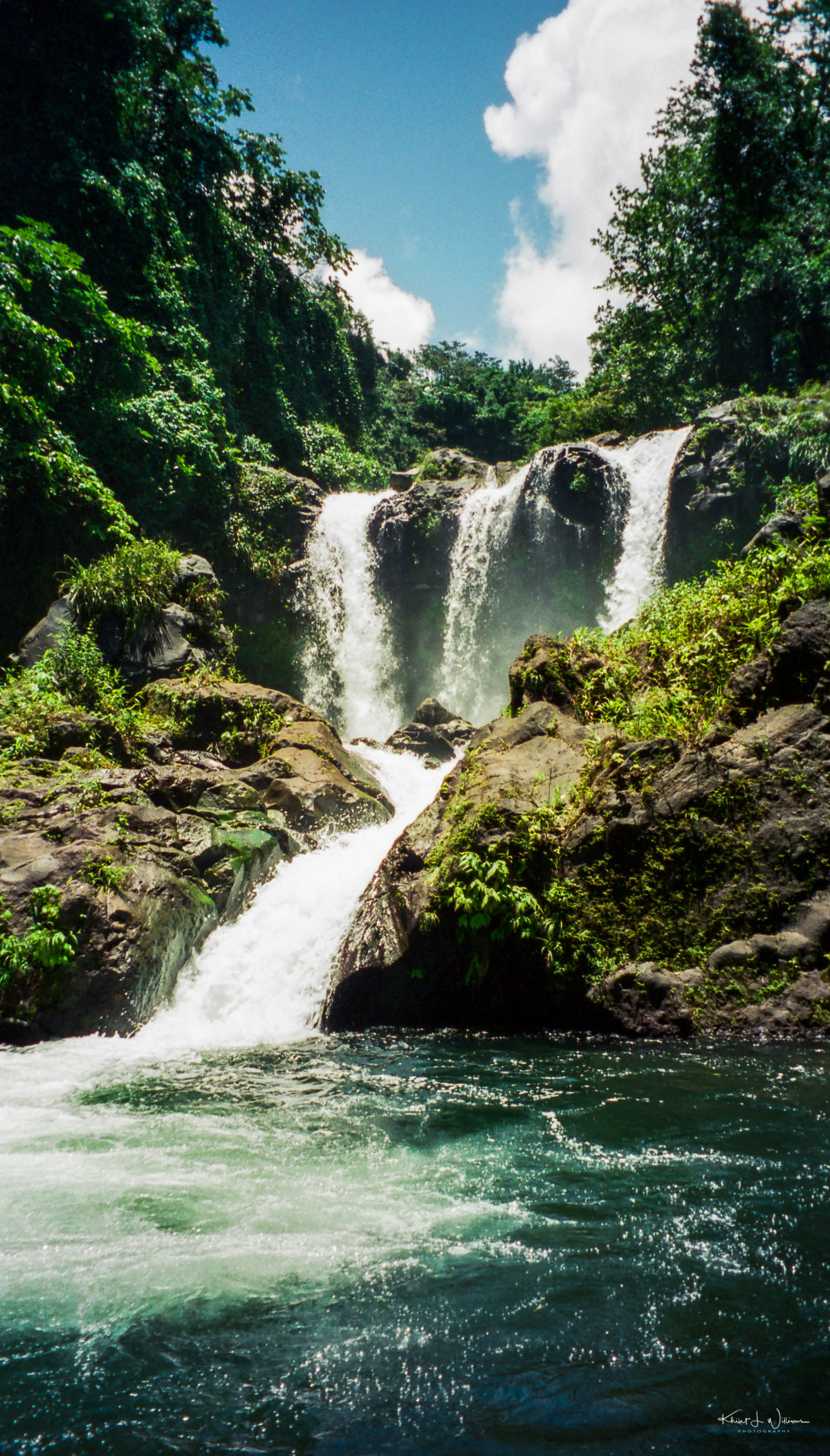
I was born and raised on the tiny Caribbean island of St. Vincent. St. Vincent and the Grenadines is an Eastern Caribbean island nation, with its capital in Kingstown on the main island of Saint Vincent. The country is renowned for its natural beauty, including rainforests, volcanic terrain, and picturesque beaches. Its economy relies on agriculture, tourism, and offshore banking.

Growing up, my cousins and I would always go on adventures together. One of the most memorable experiences of my life was hiking with my cousins to the top of La Soufrière volcano.

La Soufrière is not to be confused with Soufrière Hills in Montserrat, La Grande Soufrière in Guadeloupe, or the Soufrière Volcanic Center (Qualibou) in St. Lucia. La Soufrière means "sulfur outlet" in French, and I can only imagine that the people who colonised St. Vincent (Saint-Vincent), Guadeloupe, and St. Lucia (Sainte Lucie) and Montserrat (Santa María de Montserrate) were not inspired to be original.

La Soufriere Volcano
La Soufriere Volcano · Circa 1984
La Soufriere Volcano
La Soufriere Volcano ·Circa 1984

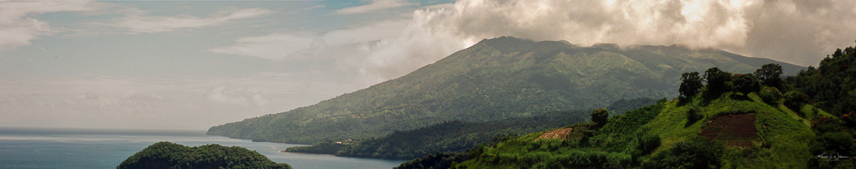
La Soufrière is an active stratovolcano in St. David Parish on the northern end of St. Vincent, the largest island in the island chain of Saint Vincent and the Grenadines. At 1,234 m (4,049 ft), La Soufrière is the highest peak on Saint Vincent and the highest point in Saint Vincent and the Grenadines. It has had five recorded explosive eruptions since 1718. The latest volcanic activity began in December 2020, leading to major eruptions starting on April 9, 2021, . Mom escaped to St. Vincent during the pandemic, living at the family home on Dorsetshire Hill in Kingstown on the southern part of the island. She could see the ash plume from the backyard. The volcanic eruption spewed ash and pyroclastic flow, a deadly mixture of superheated gases, rock and volcanic mud, but fortunately, Mom was safe on the southern part of the island.

La Soufriere Volcano
La Soufriere Volcano · Circa 1984

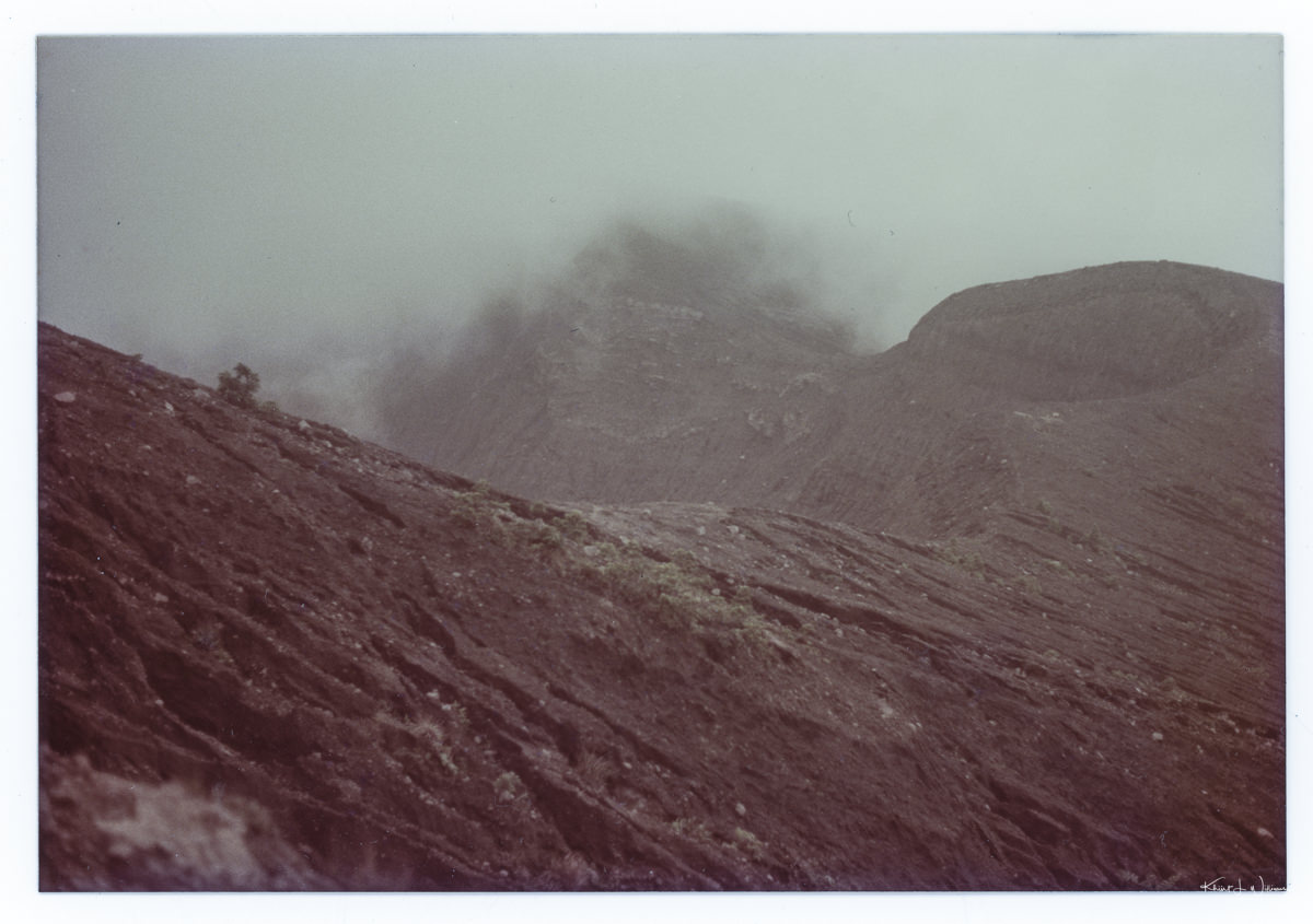
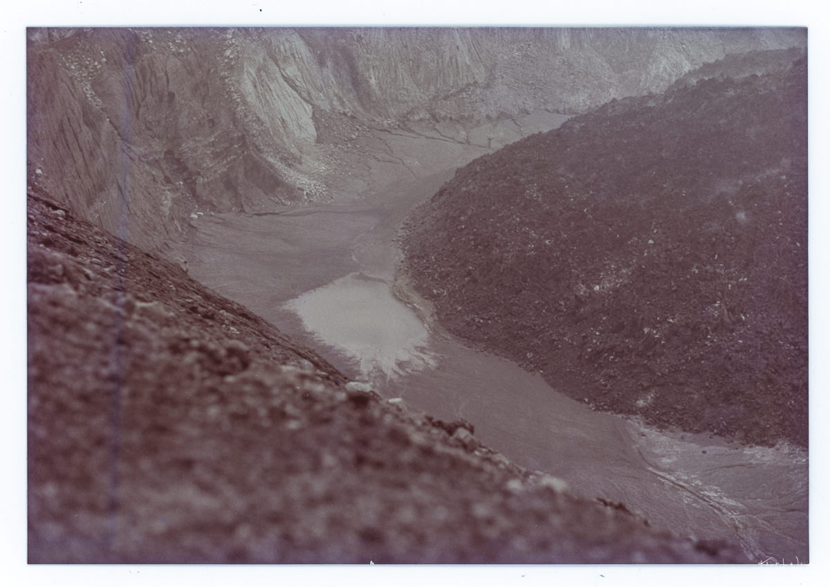
Soufrière has a crater lake, and visitors can view the volcanic crater during inactivity by following a hiking trail that ascends through the rainforest to the rim.

La Soufriere Volcano, St. David Parish, St. Vincent and the Grenadines
La Soufriere Volcano, St. David Parish, St. Vincent and the Grenadines · Circa 1984

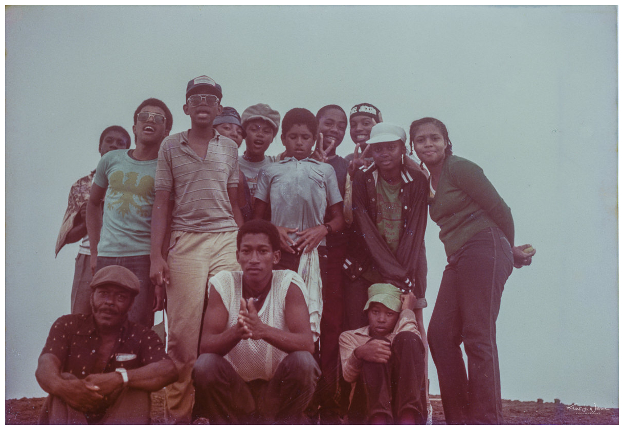
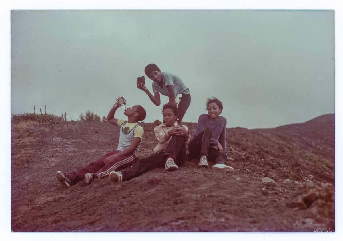
It was the summer of 1983 or 1984 when I was 17 or 18. We had just moved back to St. Vincent from Antigua and had to reacquaint ourselves with a side of the family we had not seen in almost a decade. My [Uncle Clifford] was the Chief Surveyor for the government of St. Vincentian and the Grenadines. He knew all the fantastic and remote places on the island and how to get to them. One day he arranged for a hike to the rim of La Soufrière volcano. I don’t recognise all the faces in the photographs. The group included my cousins (standing right to the left) Debbie, Karen, Samantha, Iain, my youngest brother Bruce, family friend Sheridan, Alana Hull, myself, and an unknown. It’s been about 40 years since our adventure, and I regret that I don’t recognise some of the faces or remember the names of the people in the front row.

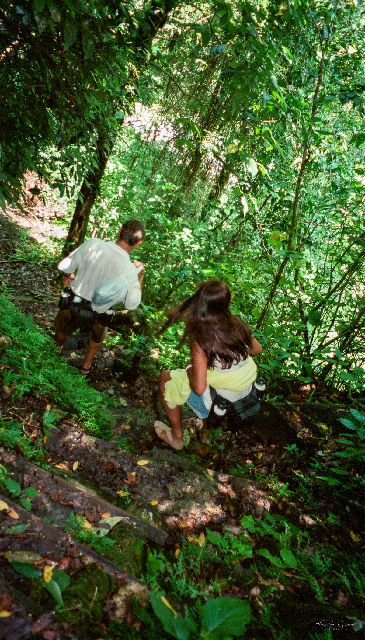
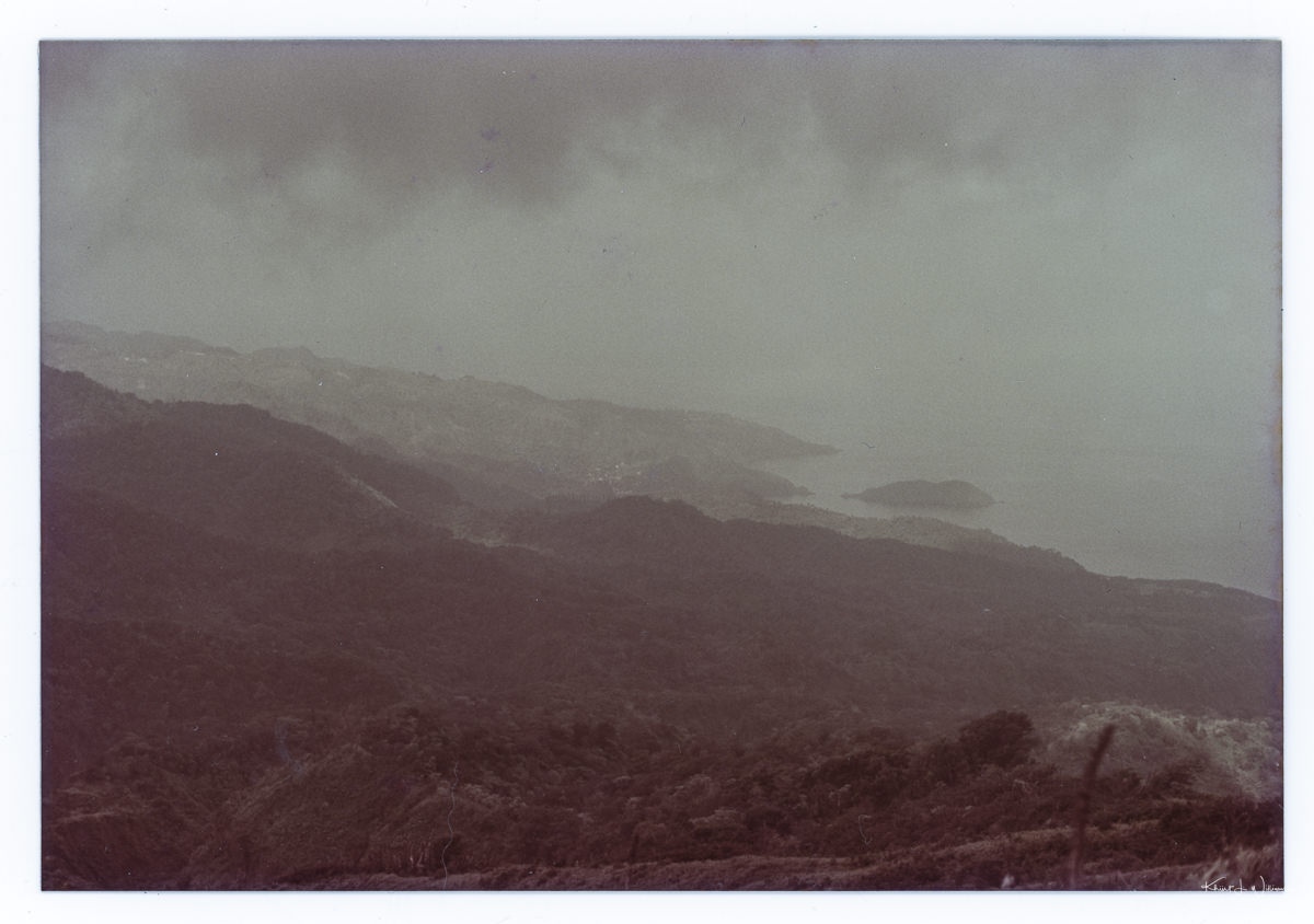
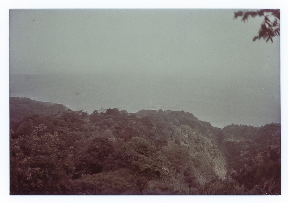
Setting out in the early morning from my Uncle’s home in Ratho Mill, we packed our bags with water and squeezed into the back of Uncle Clifford's Land Rover. We arrived at the trailhead under thick clouds and set off on the trail. The only way to get to the top was by foot, so we had to hike for miles through the thick, hot, humid tropical rainforest to reach the summit. The trail was steep and covered in loose rocks, but we took our time and often stopped to rest and take in the scenery.

La Soufriere Volcano
La Soufriere Volcano · Circa 1984

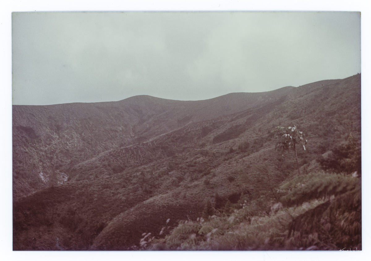
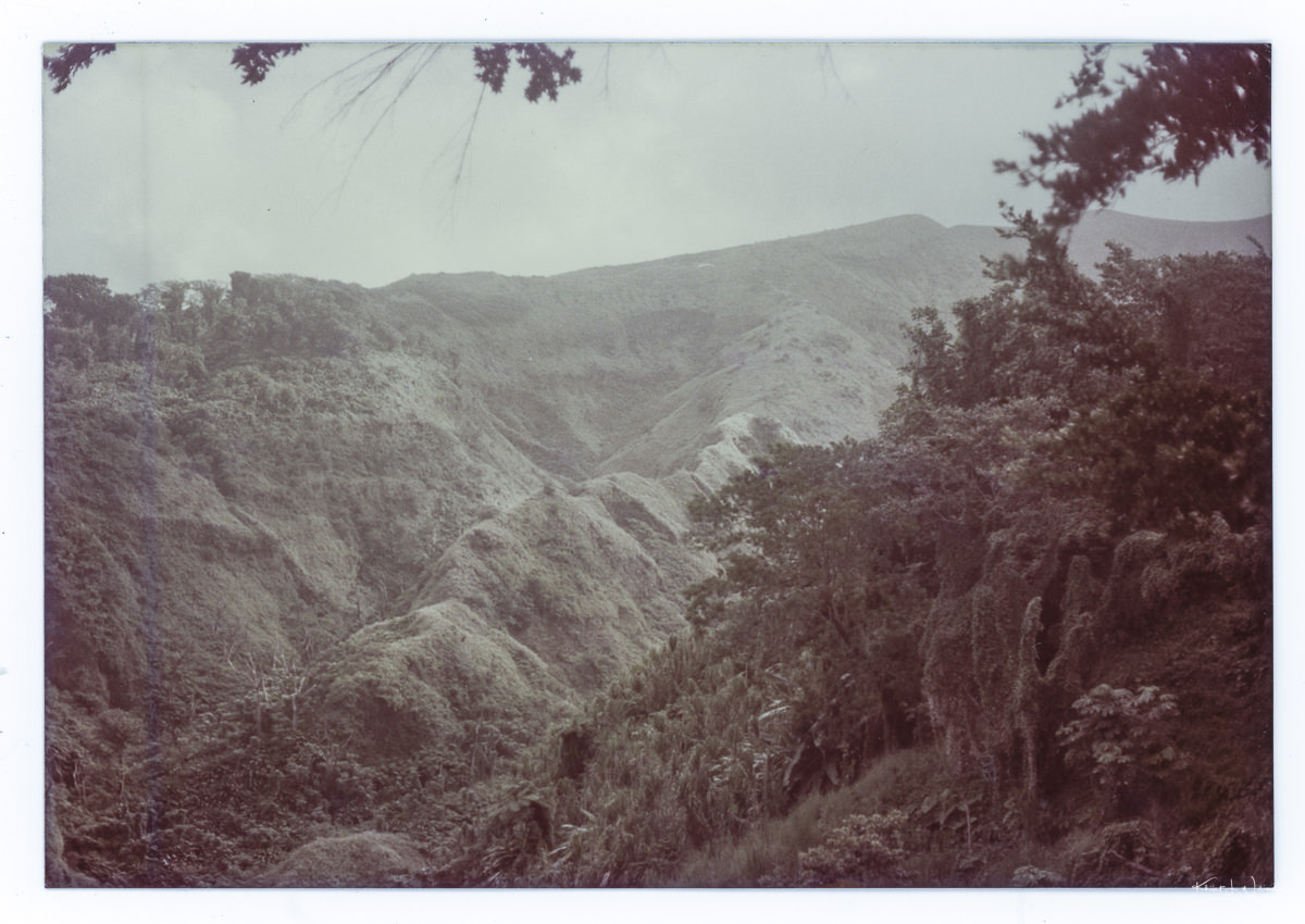
As we hiked higher and higher, the vegetation changed from dense rainforests to scrubby bushes and barren rock. The hike was challenging even for young teenagers, but it was worth it when we reached the top and saw the stunning views.

La Soufriere Volcano
La Soufriere volcanic rim · Circa 1984

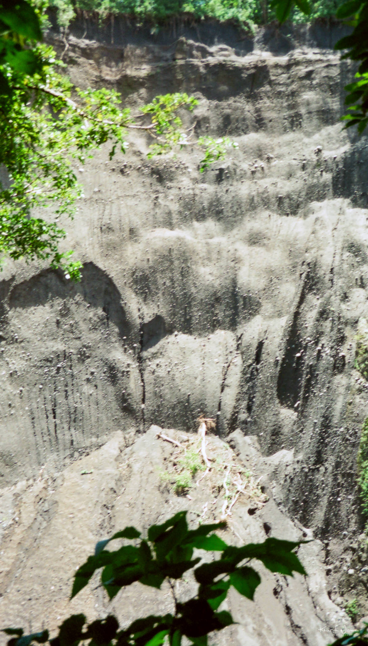
The view from the summit was incredible. We could see for miles in every direction. We even got to see lava mud bubbling inside the crater!

La Soufriere Volcano
La Soufriere volcanic crater · Circa 1984

We were exhausted when we reached the rim, and our bodies were cold from such high altitudes. We had no coats. But luckily, my Uncle Clifford had brought a bottle of rum to sip, which warmed us up in no time. Warming up with a few sips of rum made the experience more exciting for my teenage mind.

After spending some time at the top, we started to head back down. We were again hot and exhausted when we reached the bottom, but it was a hike to remember.

Hiking around the woods and forests of New Jersey is one of my favourite activities. My love of hiking may have come from these experiences with Uncle Clifford. I'm so grateful that I had the opportunity to do it in such a beautiful place with my family. It was an incredible experience. The views from the top were breathtaking, and I'll never forget how excited I was to stand at the edge of an active volcano, and I'll never forget warming my cold body with rum at the end of the day!

Drinking rum at the rim of the volcano
Iain, Giselle, Alana and Bruce (back) ·

If you ever have a chance to visit St. Vincent, I highly recommend climbing the volcano! Just wear good shoes and bring plenty of water - you'll need it for the hike!

I am unsure, but my Uncle Clifford captured these photographs. He was an avid photographer and videographer, perhaps due to his work surveying lands for the St. Vincent government. The back of the prints says Printed on Kodak Paper, and I can only assume that the film stock was also from Kodak.

Leeward Highway

Continuing my need to post about photographs taken decades ago on long-forgotten film cameras, today I am posting the last pictures from the before-kids vacation Bhavna, and I took to St. Vincent & The Grenadines. I wrote about my trip to Bequia to spend some time with my grandmother and the nature hike we took out to Trinity Falls when staying on the mainland at the Bank House with Dad. But I still have a few pictures from our drive along the Leeward Highway to Trinity Falls.

Barrouallie | Saturday 8 August 1998

Most of the roads in St. Vincent are narrow one-lane roads that wind around the outer rim of the mountain ridge from the southern coast of the mainland up to the La Soufrière volcano on the northern end. One such road is the Leeward Highway. Using the word highway to describe this road is a stretch of the modern North American understanding of the word. However, according to Wikipedia, the word highway can be used for any major roadway. The British definition is a legal term to describe "...any route or path with a public right of access, including footpaths etc.". So the Leeward Highway is a major public road along the east coast of the mainland. Got it?

Saturday 8 August 1998

The roadway was so narrow that at one point, the driver asked us to exit the minivan and stand back while he navigated past another vehicle. The tyres of the back of the minivan were on the very edge of the left side of the road. One mistake and a 200-foot drop awaited the vehicle and its driver.

La Soufrière Volcano
La Soufrière Volcano | Saturday 8 August 1998

And for those who don’t know the word leeward, it's a nautical term to describe the side of a ship facing the direction toward which the wind is blowing and the side opposite the windward. In the Caribbean Sea, leeward is west, and windward is east. Got it?

While the highway is narrow and bumpy, the drive offers spectacular cliff top views, hidden bays, flora and fauna. We drove through Barrouallie, a small village established by French settlers in 1719 and the first European colony on St. Vincent. We also went through the town of Walliabou. Wallilabou Anchorage was one of many locations in St. Vincent and the Grenadines where Disney Studio filmed the movie ‘Pirates of the Caribbean’.

Bhavna following our trail guide. Trinity Falls, Wallibou | Saturday 8 August 1998

The nature trail is to the north of Chateubelair, a large fishing village with archaeological significant rock carvings believed to have been left by Kalinago, the native inhabitants of the islands. Near the foot of the La Soufrière volcano, the nature trail is accessible from the Leeward Highway. Some of the previous trails had eroded and caved in.

Trinity Falls, Wallibou | Saturday 8 August 1998

Apologies for the quality of these photographs. When we took this vacation, APS film was being pushed by Kodak as the future of film photography. I was ignorant and bought into the hype. I purchased an APS film camera and several rolls of APS film, which was the worst camera to bring on a vacation. The quality of APS film was inferior to the 35mm film format it was intended to replace. 35mm film is still made and sold, but APS (along with Kodak) was relegated to the dustbin of history.

Trinity Falls Waterfall

With its many waterfalls, rivers, lush tropical rainforest and mountains to explore, mainland St. Vincent is astonishingly beautiful.

In 1998, after my brother's wedding ceremonies in Antigua, Bhavna and I took a three-day excursion to St. Vincent & The Grenadines. We stayed with Dad at the The Bank House and I promised Bhavna that we would do something special after visiting my grandmother in Bequia.

With its many waterfalls, rivers, lush tropical rainforest and mountains to explore, mainland St. Vincent (the big island) is astonishingly beautiful. When it’s not actively spewing ash and hot lava, one can hike to the top of the La Soufrière volcano1. Of course, I had to show Bhavna the beauty of the land of my birth.

The Wallilabou River is a river northwest of Saint Vincent. It rises in the Morne Garou Mountains between Richmond Peak and Mount Brisbane, flowing west to reach the Caribbean Sea north of Chateaubelair. Trinity Falls is near the Wallilabou River in the town of Wallilabou in the parish of St. David on the Leeward side of the island. Mom’s cousin ran an eco-tourism company. She made a few calls, and soon Bhavna and I were booked for a one-day nature hike to Trinity Falls.

Trinity Falls, Wallibou
Trinity Falls, Wallibou | Saturday 8 August 1998

Our nature guide picked us up at the The Bank House in a tiny Suzuki minivan popular on the island in the 1990s. He warned us that the hike to the falls would be long and strenuous and that we wouldn’t be able to carry much in the way of food and drink except for the curry potato roti wraps and bottled water he packed for our lunch.

The drive to Trinity Falls took longer than I had anticipated, almost two hours. The roads are narrow, mostly unpaved, with treacherous drops into the valley. Our driver drove slowly, hugging the Leeward Highway, which at times was only as wide as two cars with maybe half an inch between them when side by side. We passed through Layou, Barrouallie and finally Wallilabou. We hiked from the trailhead through the damp forest, working up a sweat on our way to the falls.

Trinity Falls, Wallibou
Trinity Falls, Wallibou | Saturday 8 August 1998

It was a long, hot walk, and a dip in the cold river water was something Bhavna, and I looked forward to! The beauty that unfolded in front of us was terrific; three powerful waterfalls tumbled into a wide river basin and then flowed into another basin below. The water was cold, but rock slabs warmed us as we basked in the sun. I could feel the strong pull of the water. We nestled in between the rocks and had a blast.

Due partly to landslides and floodwaters that have washed away rainforest and bushes above the falls, the conditions at the waterfall are hazardous. Trinity Falls has been declared a danger zone and is closed to visitors.


I think it’s interesting how memory works. When I saw this week’s Len’s Artists Photo Challenge topic, Three of a Kind, I struggled with what I would do. Should I go out looking for subject matter? Should I pull something from the Adobe Lightroom catalogue? I launched Adobe Lightroom, and I was presented with a scanned photograph of my Acura Integra that I had edited a few days earlier. While looking at the photo, I noticed that it had a date of August 1998, but it was stored in the 1996 folder. I moved the photo to the August 1998 folder and immediately saw some photographs from my brother’s wedding taken that same month. While looking at the pictures from the wedding, I saw the photos of the waterfall. I did not remember which waterfall I had photographed, so off to Google, I went. It wasn’t until after I realised that they were of Trinity Falls that I had my response to the challenge.

Was this serendipity, or did my mind lead me to this?


Apologies for the quality of these photographs. When we took this vacation, APS film was being pushed by Kodak as the future of film photography. I was ignorant and bought into the hype. I purchased an APS film camera and several rolls of APS film, which was the worst camera to bring on a vacation. The quality of APS film was inferior to the 35mm film format it was intended to replace. 35mm film is still made and sold, but APS (along with Kodak) was relegated to the dustbin of history.


  1. When I was in high school, my Uncle Clifford took me, my brothers and some cousins to hike to the top of the La Soufrière volcano. Uncle Clifford was the Chief Surveyor for the government of St. Vincentian. He knew all the cool places to visit and how to get to them.