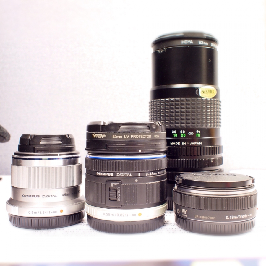
Micro 4⁄3 lenses borrowed from a friend. I'm hoping to find a vacation camera. I'm tired of lugging about the bulky DSLR. A friend loaned me his PEN EP-3 and his lenses to try out.
Published via Pressgram
Island in the Net by Khürt Williams
Technology and Photography Musings. Established circa 2000.
Micro 4⁄3 lenses borrowed from a friend. I'm hoping to find a vacation camera. I'm tired of lugging about the bulky DSLR. A friend loaned me his PEN EP-3 and his lenses to try out.
Published via Pressgram
Ohai is your journal for keeping track of where you've been and what you've done.
I "discovered" this app, which was built on the app.net, network a few weeks ago. It's software designed to keep a private journal of one's travels. I started using it a few days before a recent vacation to Virginia Beach. I used it on the drive down. We stopped on the Chesapeake Bay Bridge Tunnel and I added a few photos and a few lines of text along with a photo.
[fusion_builder_container hundred_percent="yes" overflow="visible"][fusion_builder_row][fusion_builder_column type="1_1" background_position="left top" background_color="" border_size="" border_color="" border_style="solid" spacing="yes" background_image="" background_repeat="no-repeat" padding="" margin_top="0px" margin_bottom="0px" class="" id="" animation_type="" animation_speed="0.3" animation_direction="left" hide_on_mobile="no" center_content="no" min_height="none"]

The app is simple to set up and use. I signed in using my app.net using the Passport app. You don't need the Passport app to sign in but you do need an app.net account.
[/fusion_builder_column][fusion_builder_column type="1_1" background_position="left top" background_color="" border_size="" border_color="" border_style="solid" spacing="yes" background_image="" background_repeat="no-repeat" padding="" margin_top="0px" margin_bottom="0px" class="" id="" animation_type="" animation_speed="0.3" animation_direction="left" hide_on_mobile="no" center_content="no" min_height="none"]

After that Ohia! displayed a screen with the date, a map and a check-in button. This app is designed to be simple to use.
[/fusion_builder_column][fusion_builder_column type="1_1" background_position="left top" background_color="" border_size="" border_color="" border_style="solid" spacing="yes" background_image="" background_repeat="no-repeat" padding="" margin_top="0px" margin_bottom="0px" class="" id="" animation_type="" animation_speed="0.3" animation_direction="left" hide_on_mobile="no" center_content="no" min_height="none"]

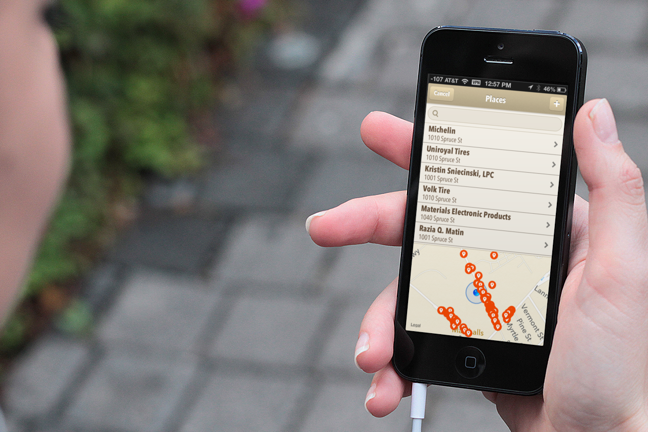
Once I tapped the check-in button, a new screen was displayed with a list of places near me. The mapping function needs some work. I have no idea what backend database is being used but Ohai! didn't find places easily found via Yelp or Foursquare.
For example, it found the Trenton Farmers' Market but not the Button's Creperie inside the market. Fortunately, the developer has provided a way to add addresses.
[/fusion_builder_column][fusion_builder_column type="1_1" background_position="left top" background_color="" border_size="" border_color="" border_style="solid" spacing="yes" background_image="" background_repeat="no-repeat" padding="" margin_top="0px" margin_bottom="0px" class="" id="" animation_type="" animation_speed="0.3" animation_direction="left" hide_on_mobile="no" center_content="no" min_height="none"]

I added a photo to my check-in and a sentences describing my thoughts in the moment before submitting my journal entry. I can choose to keep my journal private or share with app.net or twitter. That's all to the app.
Ohai! is truly meant to be used for capturing the moment. There is no way to go back and edit an entry later or add text or images to a earlier entry.[/fusion_builder_column][/fusion_builder_row][/fusion_builder_container]
Whenever I'm shooting or travelling, I have two cameras; my Nikon and iPhone. However, I often shoot more with the iPhone than the Nikon. Perhaps it's the immediacy of it, but sometimes I prefer the images captured on the iPhone to the ones I caught on the Nikon.
My iPhone lens has a scratch, though. Right in the middle of all my images is a small dot. I thought about waiting until I returned from my trip to remove it in Adobe Lightroom.
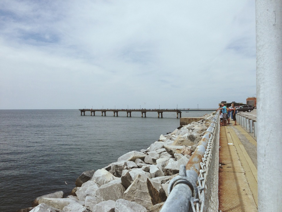
We left New Jersey around 8 AM and made real-time through Delaware along the scenic Route 13. We stopped in Salisbury, Maryland, just around lunchtime, choosing to dine at Panera. We got to the Chesapeake Bay Bridge-Tunnel around 3 PM and stopped again to look around.
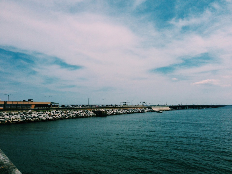
Bhavna and I have crossed this bridge a few times on our way to Virginia for a business trip, but this is our first time with the kids. We stayed for 30 minutes, watching people fish along the pier.


We made it to our destination, an eight-bedroom rental property on Sandbridge, before the rest of Bhavna's family, so we had some time to explore.

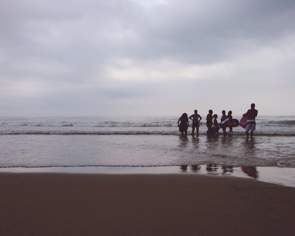
We made it down to the beach the next day. It was very overcast but bright—very soft lighting.

The water was cold. Not that it mattered to me. Ocean water must be blue-green before I step foot in it. The older kids and adults enjoyed using boogie boards while I snapped photos of the smaller kids playing in the sand.

We had a storm that night. The beach was a different place the next day. There were jellyfish carcasses along the sand with bits of driftwood and broken shells.

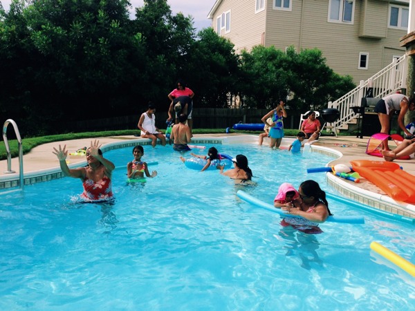
We only stayed a short time at the beach that day. The water felt even colder than the previous day, so I returned to the pool. Everyone else returned an hour later. We splashed at the pool right up until dinner time.
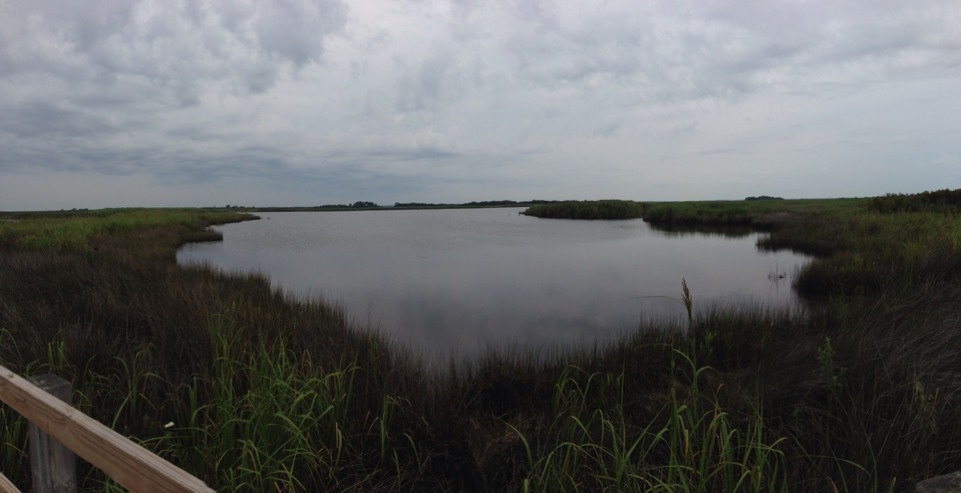
The Charles Kuralt Trail has been established to help people enjoy these wildlands and to recognise the broadcast journalist who shared the delights and wonders of out-of-the-way places like these.