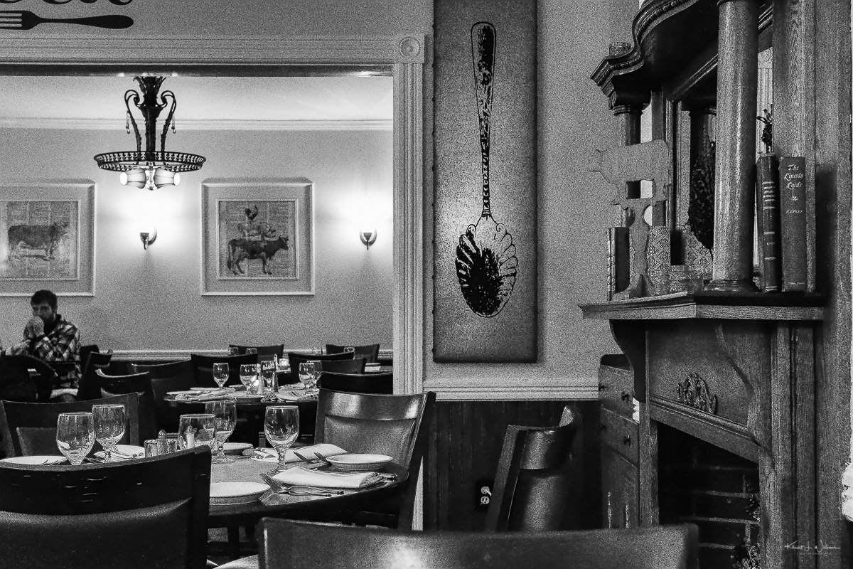
The only photographs I captured this past week are from dinner at Rocky Hill Inn to celebrate my nephews ninth birthday. The weather was cold and wet this week, through the weekend. It snowed on Thursday night, and Friday morning, a layer of snowfall and rain made the roads slick. The second layer of snow fell on the driveway very early on Saturday morning. I bundled up in layers of clothing to clear that layer before the hail on Saturday evening. Just as I was creating this post on Sunday evening, my iPhone weather app just alerted me with a winter storm warning. Heavy snow is expected.
This image is of the more formal dining area of the Rocky Hill Inn. It was made by running it through Nik's Dfine 2 to remove some noise. Then it was passed through Nik's Silver EFX Pro 2 to convert it to black and white. Then finally it was processed through Topaz Lab's Clean 3. I layered one image processing task after the other to create the final result.
Since it's the only image I have from my "camera roll", it will be submitted for both challenges.
Best Photo of the Week is personal photography project where I post the best image captured that week. The picture will be posted at the end of the week. That will be a Sunday. I can take one or 100 photos for the week, but I will post only one, the best one.
*Created by photographer Frank Jansen, the Tuesday Photo Challenge is a weekly theme-based challenge for photographers of all kinds to share both new and old photography.
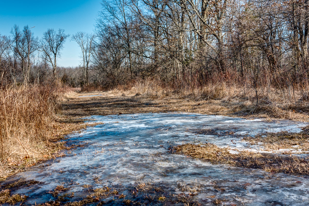
I walked on the path cut into the grassland, encountered ice and swamp-like mud. I slipped and slid, twisted and hurt something in my right foot. But I didn't know that at the time. Just a lingering feeling that I had overdone it. That something wasn't right.
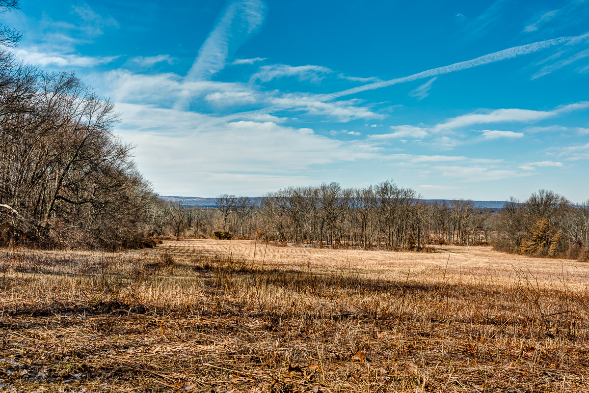
Planes crawled across the sky over Franklin Township, travelling to and fro Newark Liberty International Airport. I walked on the path cut into the grassland and encountered ice and swamp-like mud. I slipped and slid, twisted and hurt something in my right foot. But I didn't know that at the time. Just a lingering feeling that I had overdone it. That something wasn't right.
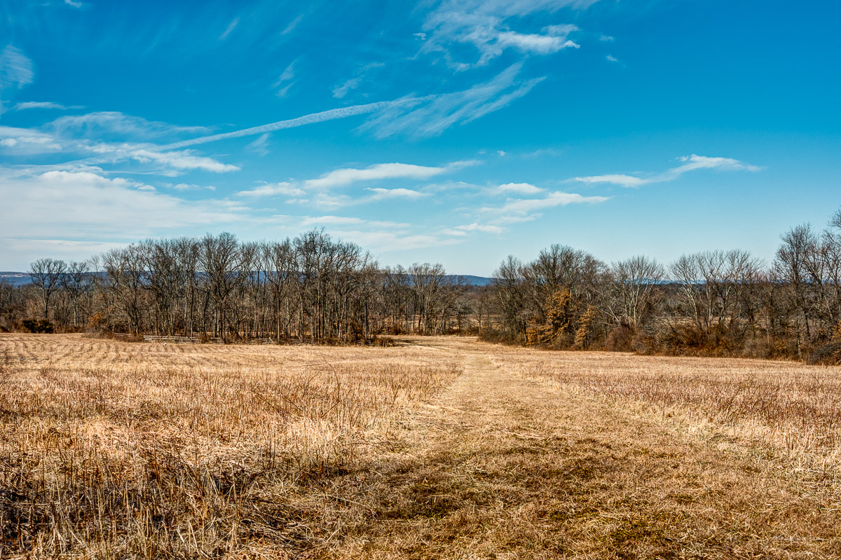
While perusing the REI online store, I learned about the Griggstown Native Grassland Preserve. I was checking out the sales items and saw a link for the REI Hiking Project. Thirty minutes later, I downloaded the Hiking Project app and looked at a list of nearby possibilities for a hike. I decided to try the Griggstown Native Grassland because it was close to home. A grassland hike would differ from my usual hikes in the Sourland Mountain Preserve.
I rented a Fujinon XF27mmF2.8 pancake lens for a weekend trip to visit my brother in Charlotte, North Carolina. We had to postpone our plans, and while I could cancel my flight and hotel booking, I forgot about the lens rental. I felt I had to get some value from the lens, so I put it on my Fuji X-T2 and brought it with me on my hike. With a ~41mm full-frame sensor equivalent field of view, the XF27mmF2.8 provides a field of view roughly equal to that of the human eye. The photos would give a "Khürt's Eye View" of the hike on this hike.
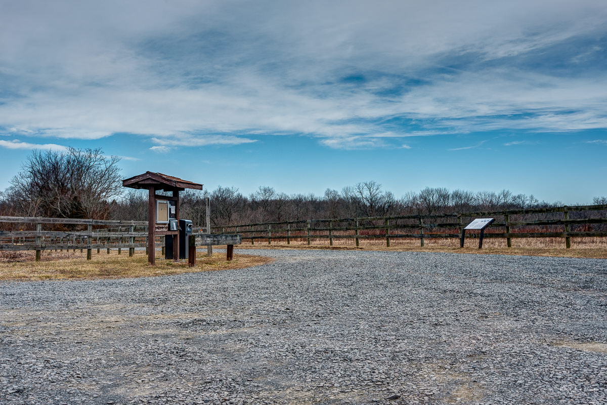
I drove along Canal Road, and despite using Google Maps, I almost missed the preserve entrance. The entrance is via a narrow dirt road that winds its way around the trailhead. Hikers have parked two other cars. I grabbed my stuff and walked to the information shed to look for a map. I could not understand the map on the back of the shed.
I pulled out the Hiking Project app, which has GPS to pinpoint my location. One thing to note about using a GPS app on a smartphone. They are only accurate to about 50 feet. To increase accuracy, these apps often use cellular or Wi-Fi signals. The Hiking Project app uses the GPS information from my iPhone and the cellular signal to place my location on its preserve map. The hiking app won't accurately locate you on its map if you are in an area with a poor (or no) cellular signal. Your phone knows your coordinates, but the app does not.
I got some information about the two gentlemen preparing to hike in the preserve. There was a small Blue Trail and a larger Red Trail. I decided to take the Red Trail.
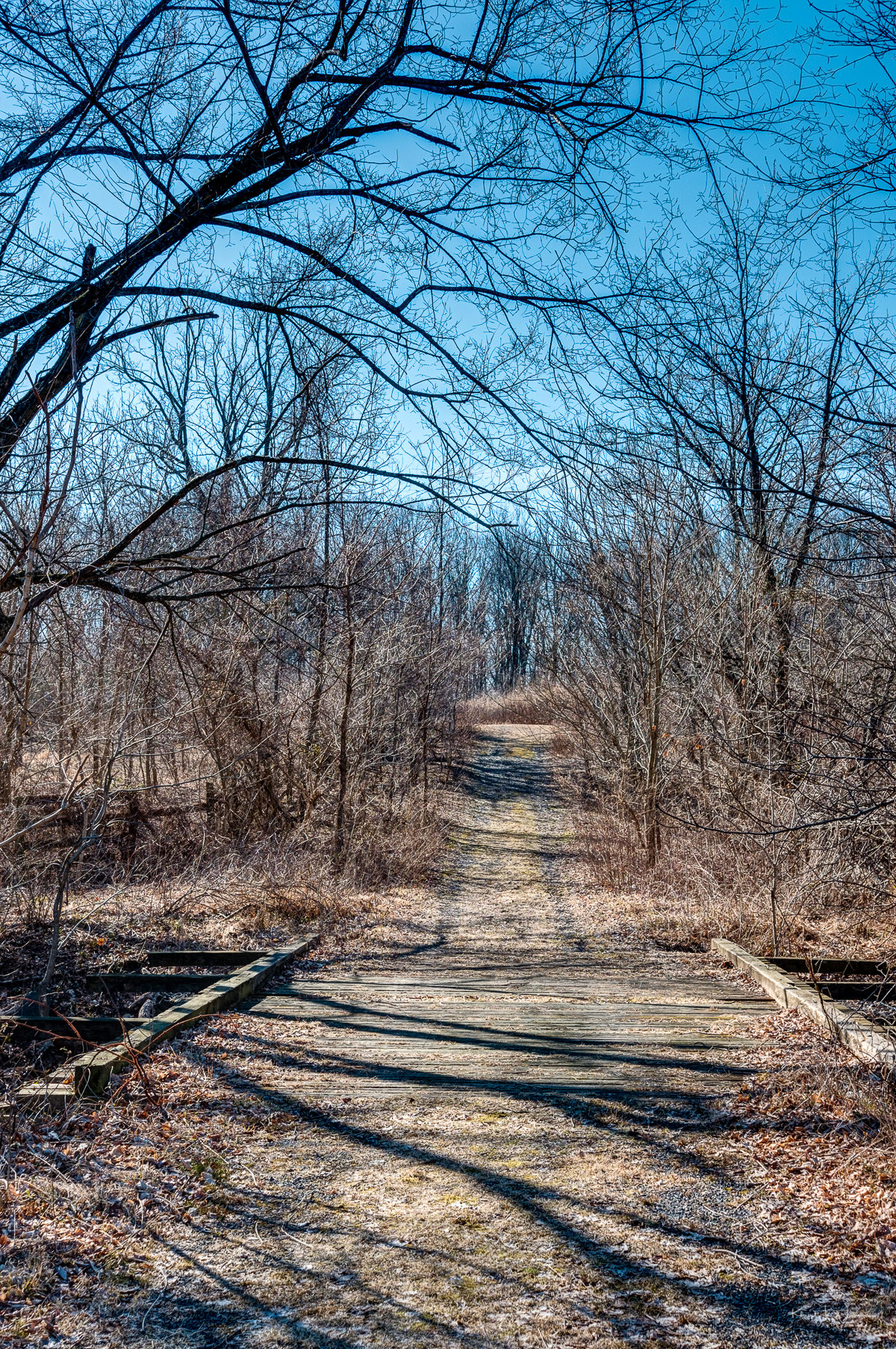
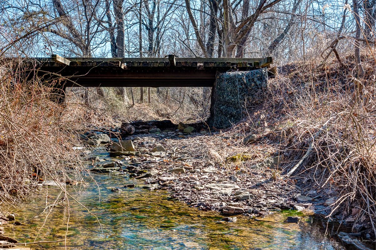
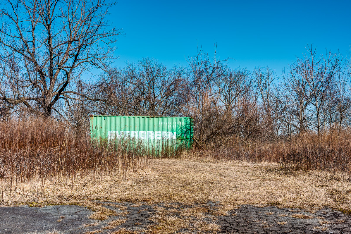
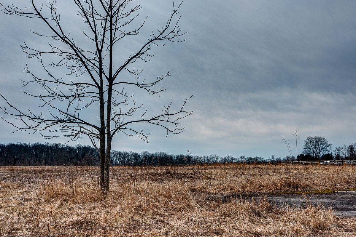
The trails are not well marked. I walked across the wide grassland trail and felt a sense of openness. This is rare here in New Jersey. I walked across a bridge and around a path that took me to an abandoned shipping container. Ironically the words, Evergreen, were printed on the side. I continued walking and realised that I had just walked in a circle.
Remember what I wrote earlier about GPS and cellular signals? I consulted the Hiking Project app and realised I had walked off the trail. I walked back across the bridge and re-entered the trail. This part of the trail was very wet, soggy, and muddy. It didn't help that the trail path was cut through the grass. I was walking on wet grass on top of damp soil.
I walked up this hill, slippery from water frozen into shoe prints leftover from another hiker. At the top was a park bench, and I stopped for a moment to take in the Sourland Mountain Range view. It looked so small in the distance.
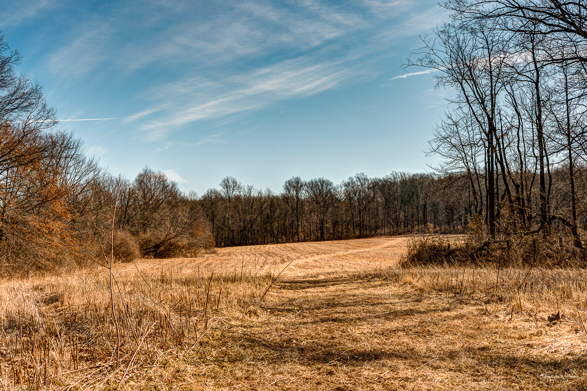
I consulted the Hiking Project app and realised I was almost done with the red trail. Ahead across large patches of ice, lay the path to the Orange Trail. I slid my way across, slowly crawling to the other side. The path ahead was again soggy and wet. Arriving at the fork in the trail to start the orange trail, I saw even more ice and wet, muddy areas. I reconsidered my options. Take the exit path back to the trailhead or complete the orange trail. I decided I had had enough and took the route back to the car.
It was 3:30 AM when I uploaded these photos. I was in pain. I couldn't get to sleep because of the intensity of the pain. I uploaded the images, posted a link on Frank's website's comments section, and went back to bed. This morning my wife took me to the doctor. I had a sprained tendon and will wear a boot for a few weeks while my foot heals.
The Tuesday Photo Challenge is a weekly theme-based challenge for photographers of all kinds to share both new and old photography.
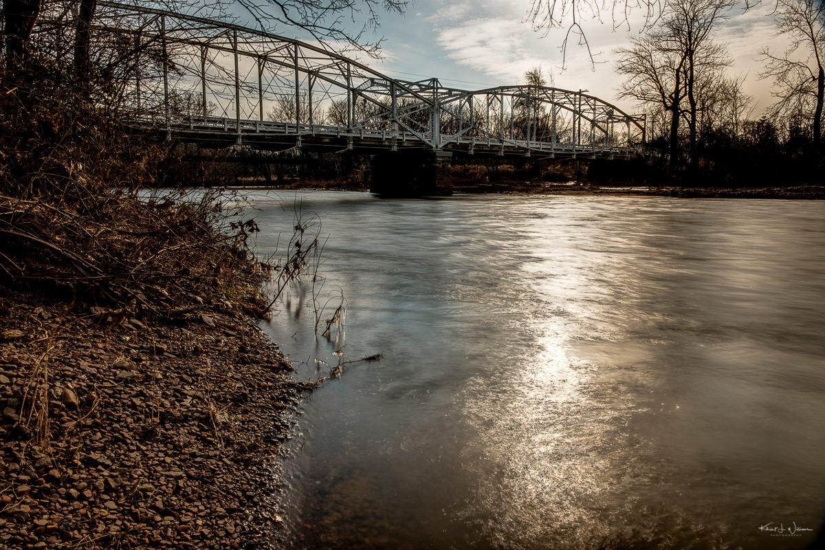
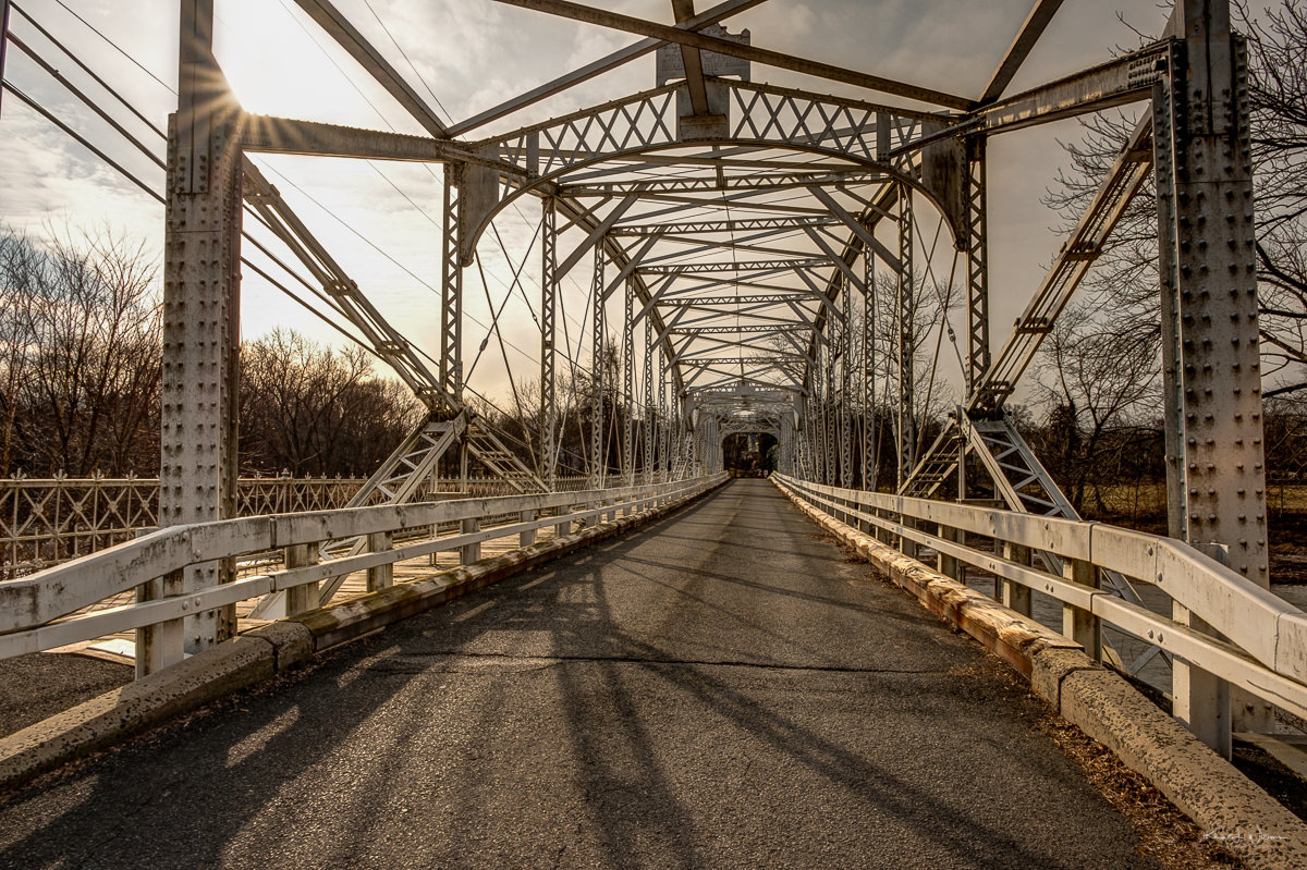
This Neshanic Station Bridge, also known as Elm Street Bridge, has been on my to-do list for several years. Whenever I visit my brother-in-law in Annandale or stop at Conclave Brewing for a pint, I route through Hillsborough and Neshanic Station. On this occasion, I was returning from completing a photo project. I had spent the morning photographing from the south branch of the Raritan River in Clinton Township.
Neshanic Station is an unincorporated community within Branchburg Township in Somerset County, New Jersey. Notably, in 2016, a significant portion of the village was recognised for its historical value and added to the National Register of Historic Places as the Neshanic Station Historic District. On the drive out to Clinton, I slowed down, paid attention to potential parking places, and made a mental note to stop on the way back.
When I started my return drive home, the sun was lower in the sky. I parked on the shoulder of the road on the eastern side of the Raritan River. I could easily see the banks of the River. I grabbed my camera and tripod and went to the river bank through the brush. The snow or ice had melted, and the ground was muddy and slippery. I slid down to the river bank. I almost slide right in. My shoes were full of chunks of mud, but I set up my tripod and grabbed a few shots from a few locations.
Neshanic Station Bridge, Branchburg Township, Somerset County, New Jersey — FujiFilm X-T2 + Fujifilm XF16-55mmF2.8 R LM WR @ (16 mm, f/10, ISO200), Copyright 2019-01-26 Khürt L. Williams
So what do I know about this bridge? I gathered from various online sources that The Elm Street Bridge, also known as the Neshanic Station Bridge, is a lenticular truss bridge that carries Elm Street (Somerset County Route 667) over the river out of the community to River Road. Because of the length of the Raritan River, there are quite a few towns in New Jersey with a River Road.
Constructed in 1896 by the renowned Berlin Iron Bridge Company of East Berlin, Connecticut, this bridge comprises two spans and spans a length of 285 feet. Even after over a century, the Elm Street Bridge remains true to its original design and maintains its historical significance. In 2007, Somerset County undertook a rehabilitation project to ensure the preservation and maintenance of this historic structure.
We use cookies on our website to give you the most relevant experience by remembering your preferences and repeat visits. By clicking “Accept”, you consent to using ALL the cookies. However, this website has no interest in selling your information. It does not explicitly use social media cookies from Facebook, Google, Twitter, Threads, Instagram etc. Read More
This website uses cookies to improve your experience while you navigate through the website. Out of these, the cookies categorized as necessary are stored on your browser as they are essential for the working of basic functionalities of the website. We also use third-party cookies that help us analyze and understand how you use this website. These cookies will be stored in your browser only with your consent. You also have the option to opt out of these cookies. But opting out of some of these cookies may affect your browsing experience.
Necessary cookies are absolutely essential for the website to function properly. These cookies ensure basic functionalities and security features of the website, anonymously.
Cookie
Duration
Description
cookielawinfo-checkbox-analytics
11 months
This cookie is set by GDPR Cookie Consent plugin. The cookie is used to store the user consent for the cookies in the category "Analytics".
cookielawinfo-checkbox-functional
11 months
The cookie is set by GDPR cookie consent to record the user consent for the cookies in the category "Functional".
cookielawinfo-checkbox-necessary
11 months
This cookie is set by GDPR Cookie Consent plugin. The cookies is used to store the user consent for the cookies in the category "Necessary".
cookielawinfo-checkbox-others
11 months
This cookie is set by GDPR Cookie Consent plugin. The cookie is used to store the user consent for the cookies in the category "Other.
cookielawinfo-checkbox-performance
11 months
This cookie is set by GDPR Cookie Consent plugin. The cookie is used to store the user consent for the cookies in the category "Performance".
viewed_cookie_policy
11 months
The cookie is set by the GDPR Cookie Consent plugin and is used to store whether or not user has consented to the use of cookies. It does not store any personal data.
Functional cookies help to perform certain functionalities like sharing the content of the website on social media platforms, collect feedbacks, and other third-party features.
Performance cookies are used to understand and analyze the key performance indexes of the website which helps in delivering a better user experience for the visitors.
Analytical cookies are used to understand how visitors interact with the website. These cookies help provide information on metrics the number of visitors, bounce rate, traffic source, etc.
Advertisement cookies are used to provide visitors with relevant ads and marketing campaigns. These cookies track visitors across websites and collect information to provide customized ads.