This image was also used for my 365 Day Project but is the best example of leading lines from that week's images. I was lucky wit this image. Even the clouds were in on the game, with little lines of vapour leading toward the lower Manhattan skyline.
The PATH train had brake issues and was removed from service. All passengers had to exit and wait for the next train which was now even more crowded. Standing room only for the entire 25-minute ride to Exchange Place. Because of this delay, I missed the ferry and had to wait for the next one. Cascading failure. I detest public transportation.
I have used mapping apps since I've had my first iPhone, an iPhone 4. At first, Apple Maps used data from Google, but after a falling out, Apple contracted with TomTom for data. This was a near disaster for Apple but overtime Apple improved the product. I stuck with all these years but I always had Google Maps as a backup. I even used Waze for a short time.
Mapping apps have improved over time, adding the street view, walking directions, 3D maps, information for public and private transportation including trains, buses and ferries, aeroplanes.
However, the recent update from Apple and my experiences travelling to New York City had me wondering why map apps still feel so useless.
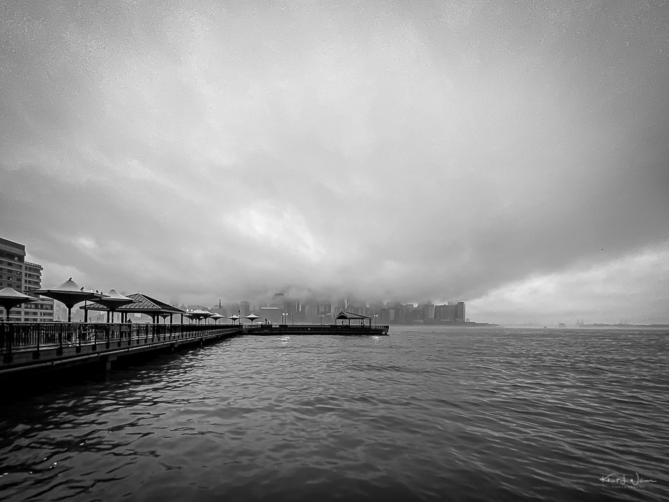
On the Hudson River Waterfront Walkway with Manhattan in the distance| Apple iPhone 11 Pro | iPhone 11 Pro back camera | 1.54 mm | f/2.4
I can get driving directions from my home to the train station. I can get travel directions from the train station to my final destination in New York City. Both Apple Maps and Google Maps will tell me which train to take, when to transfer between the New Jersey Transit station and the PATH stations, when to exit the PATH and how to walk to the pier to get the ferry to Manhattan, then providing walking directions to the building where I work once a week.
But what if I want directions for the entire trip? I can’t. I have to map out the drive from home to the train station as a separate trip from the train/ferry trip. Why can’t I simply tell Google Maps or Apple Maps to give me directions from home to the office and have the software offer me travel options via a combination of car, train, and ferry? That’s what I want.
Hudson River Waterfront Walkway with the Goldman Sachs & Co building in the distance. | Apple iPhone 11 Pro | iPhone 11 Pro back camera | 1.54 mm | f/2.4
Inside New York City, if I use the subway system, I can just tap my iPhone on a sensor and pay for my ride.
However, paying for my commute from Princeton involves using four separate apps. One app to pay for parking, another to purchase a New Jersey Transit train ticket, another to purchase a ride on the PATH train, and yet another app for a ferry ticket to cross the water to lower Manhattan. Oy!
I just want less friction on my two-hour commute! Why can’t I have it?
Pier 11, New York Cit | Apple iPhone 11 Pro | iPhone 11 Pro back camera | 1.54 mm | f/2.4
We use cookies on our website to give you the most relevant experience by remembering your preferences and repeat visits. By clicking “Accept”, you consent to using ALL the cookies. However, this website has no interest in selling your information. It does not explicitly use social media cookies from Facebook, Google, Twitter, Threads, Instagram etc. Read More
This website uses cookies to improve your experience while you navigate through the website. Out of these, the cookies categorized as necessary are stored on your browser as they are essential for the working of basic functionalities of the website. We also use third-party cookies that help us analyze and understand how you use this website. These cookies will be stored in your browser only with your consent. You also have the option to opt out of these cookies. But opting out of some of these cookies may affect your browsing experience.
Necessary cookies are absolutely essential for the website to function properly. These cookies ensure basic functionalities and security features of the website, anonymously.
Cookie
Duration
Description
cookielawinfo-checkbox-analytics
11 months
This cookie is set by GDPR Cookie Consent plugin. The cookie is used to store the user consent for the cookies in the category "Analytics".
cookielawinfo-checkbox-functional
11 months
The cookie is set by GDPR cookie consent to record the user consent for the cookies in the category "Functional".
cookielawinfo-checkbox-necessary
11 months
This cookie is set by GDPR Cookie Consent plugin. The cookies is used to store the user consent for the cookies in the category "Necessary".
cookielawinfo-checkbox-others
11 months
This cookie is set by GDPR Cookie Consent plugin. The cookie is used to store the user consent for the cookies in the category "Other.
cookielawinfo-checkbox-performance
11 months
This cookie is set by GDPR Cookie Consent plugin. The cookie is used to store the user consent for the cookies in the category "Performance".
viewed_cookie_policy
11 months
The cookie is set by the GDPR Cookie Consent plugin and is used to store whether or not user has consented to the use of cookies. It does not store any personal data.
Functional cookies help to perform certain functionalities like sharing the content of the website on social media platforms, collect feedbacks, and other third-party features.
Performance cookies are used to understand and analyze the key performance indexes of the website which helps in delivering a better user experience for the visitors.
Analytical cookies are used to understand how visitors interact with the website. These cookies help provide information on metrics the number of visitors, bounce rate, traffic source, etc.
Advertisement cookies are used to provide visitors with relevant ads and marketing campaigns. These cookies track visitors across websites and collect information to provide customized ads.